
Stagville (Orange County)
Stagville was part of an extensive plantation complex owned by the Bennehan and Cameron families from the end of the 18th century through the middle of the 20th century. Richard Bennehan began assembling what would become one of North Carolina’s largest and wealthiest plantations in Orange County in 1776 at the confluence of the Little, Eno, and Flat Rivers.
The same small ridge where Richard Bennehan’s plantation home still stands shows evidence of continual use for at least 4,000 years. The first archaeological survey found three Middle to Late Archaic-period campsites. Archaeologists cautioned, however, that it was difficult to determine the size of the sites, or to be certain about the range of activities carried out in these areas, because for many years enthusiasts had removed artifacts from the fields where the sites were identified.
Stagville is now a North Carolina State Historic Site that is open to the public. Although people have lived in this location for thousands of years, the current interpretive emphasis is on its plantation past, both before and after Emancipation.
A Family Seat
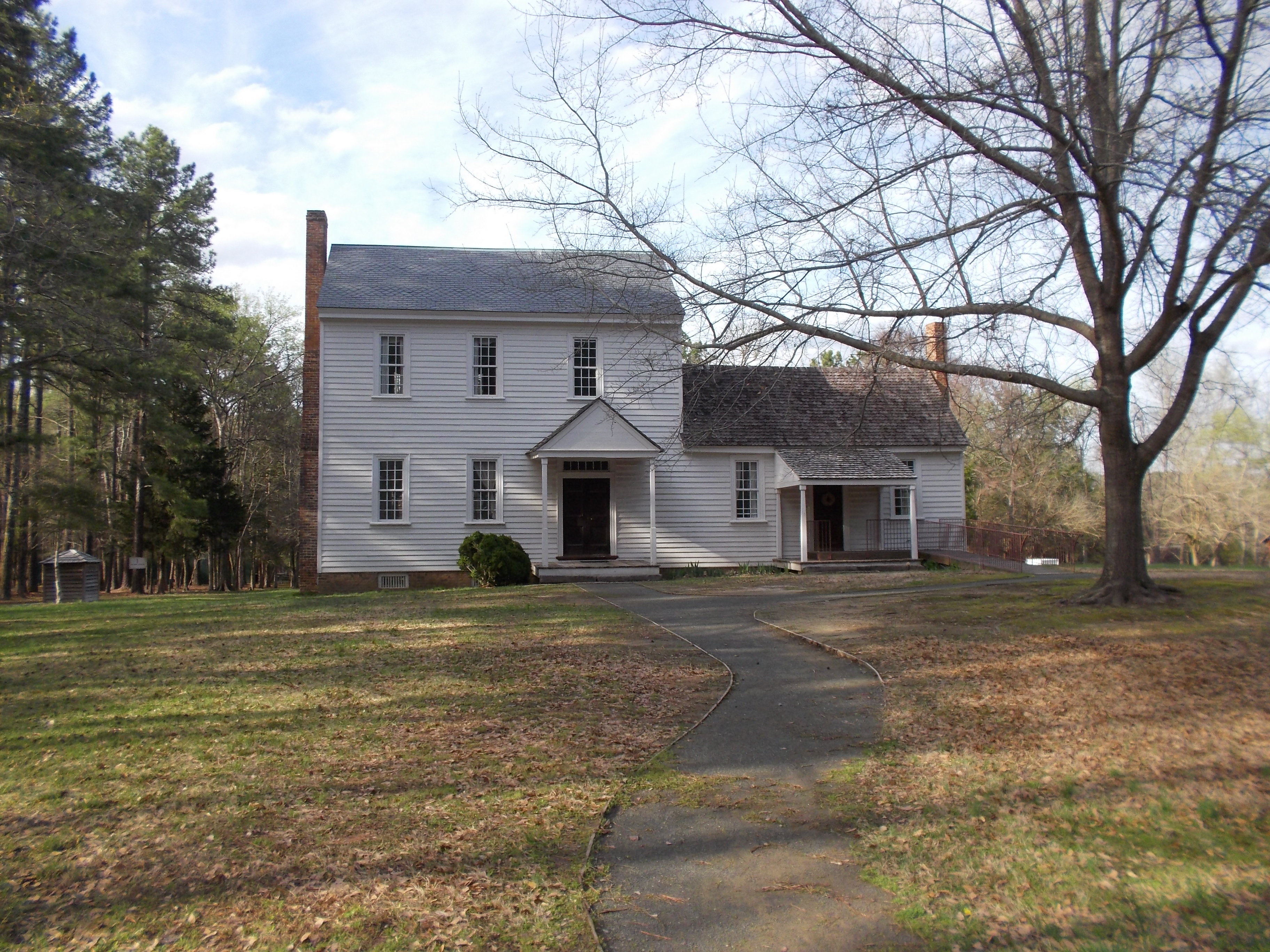
Richard Bennehan, his wife Mary Amis, and children Rebecca and Thomas Dudley lived at Stagville along with the enslaved members of the household, a group that included 31 people in 1778. Bennehan had the main house built on land acquired from Judith Stagg in 1787.
Although it was the administrative center of the plantation, the Bennehan house has seen very little archaeological study. One exception was a survey prompted by the need to make repairs to the structure, including adding septic and a water line. Plans for a parking area, access road, and classroom building brought archaeologists to conduct a pedestrian survey over much of the 71-acre property, including probing and surface troweling, which allowed the archaeological team to identify significant 18th and 19th century features and structures.
Excavation revealed the extent of modern disturbance in the areas closest to the Bennehan house. During the middle 20th century, a number of outbuildings (stables, barns, and quarters) were moved, demolished for lumber, or simply torn down. The owners of the land had used heavy machinery to level the earth near the house. Archaeologists, however, noted that a few undisturbed areas remained, including a possible privy pit that they associated with the original occupation of the structure.
The Plantation Store
The Bennehan/Cameron fortune had its origins in Richard Bennehan’s mercantile activities, but over time the family’s wealth became a product of their extensive land holdings as well as their ownership of approximately 900 men, women, and children. The family fortune all began with a partnership in a nearby store, which in later years, was located on the Stagville property itself.
Archaeologists located the old store at Stagville, its foundation, a collapsed chimney, and scatter of bricks. Nearby, they found a large, circular depression that resembled the wells found elsewhere on the Stagville property.
Thomas Dudley Bennehan (Richard’s son) inherited the store and the farm after his father died in 1825 and he lived there until his own death in 1847. He never married, which is how Stagville came into the hands Rebecca Bennehan’s husband, Duncan Cameron. Three generations of Cameron men—Duncan, his son Paul Carrington, and Paul’s two son’s Duncan III and Bennehan continued to develop the family’s holdings.
Landscapes of Slavery and Freedom
Slavery was the engine of the family’s wealth and enslaved workers labored at crafts such as coopering, milling, and ironworking, but primarily agriculture (producing corn, wheat and other grains, hogs, tobacco, and some cotton, flax, and wool).
Of all the Cameron men, Paul had the greatest impact on the development of the plantation and the lives of its inhabitants. He held his own share of the family estate along with managing property for his brother and sister. He exiled over 100 men and women from the family’s North Carolina farms to new cotton plantations that he purchased in Mississippi and Alabama. Paul initiated a major building campaign at the family’s nearby Horton Grove farm on the eve of the Civil War. And, he was at the helm of the estate when Emancipation came.
Horton Grove
Other early archaeological investigations focused on the Horton Grove tract, a nearby farm often treated as a part of Stagville. The two farms seem to have been considered a single entity by many who lived there in the 20th century. Four dwellings built to house families enslaved by the Camerons are still standing at Horton Grove.
Students participating in a geophysics and archaeobotany field school examined a two-acre area surrounding the standing structures at Horton Grove. They used plant population mapping with the idea of reconstructing the earlier botanical landscape. Memory maps created by former residents of Horton Grove mention an orchard behind the houses, vegetable gardens, and a corn field.
The geophysics project used a technique called electromagnetic resistivity that measures how resistant soil is to a current. Areas with variable resistivity appear to correlate with the location of agricultural features remembered by former residents, including a corn crib and a hog scalding area.
A probe and auger survey of the area surrounding the standing houses found several abandoned roads and paths connecting them to each other and to other buildings at Horton Grove, including a series of tobacco storage barns. Archaeologists also uncovered a brick scatter related to the demolition of an original chimney from the Hart House, the northernmost building in the row of houses that still stand today. Horton Grove was not the only location that housed enslaved workers on the plantation.
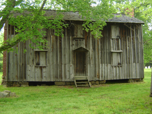
The “Slave Cabin” at Stagville
The number of enslaved residents at Stagville numbered in the hundreds. Historic records allow us to identify all by name, but we cannot always determine who exactly lived in the “Slave Cabin” at certain points in the plantation’s history. Thomas Dudley Bennehan (Richard’s son) owned and lived on the plantation from 1825 to 1847. When he died, he owned 358 men, women, and children, although who lived in the “Slave Cabin” during the pre-Emancipation era is not known. According to research conducted in the 1970s, however, Mandy and Fletcher Satterfield, Doc Dosier (who had once been enslaved), and “Uncle” Willie Veasey were among the people who lived in the structure during the first half of the 20th century.
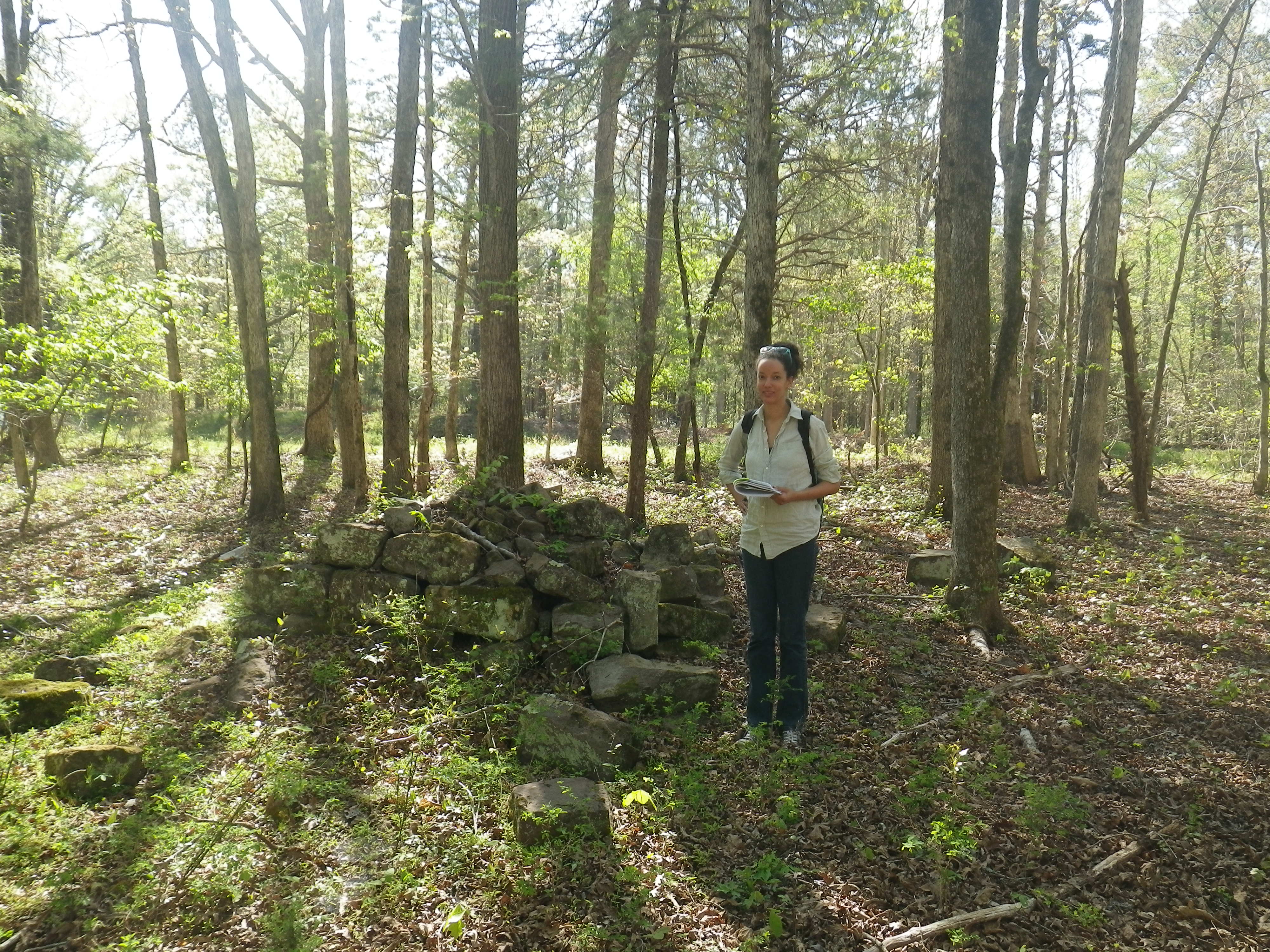
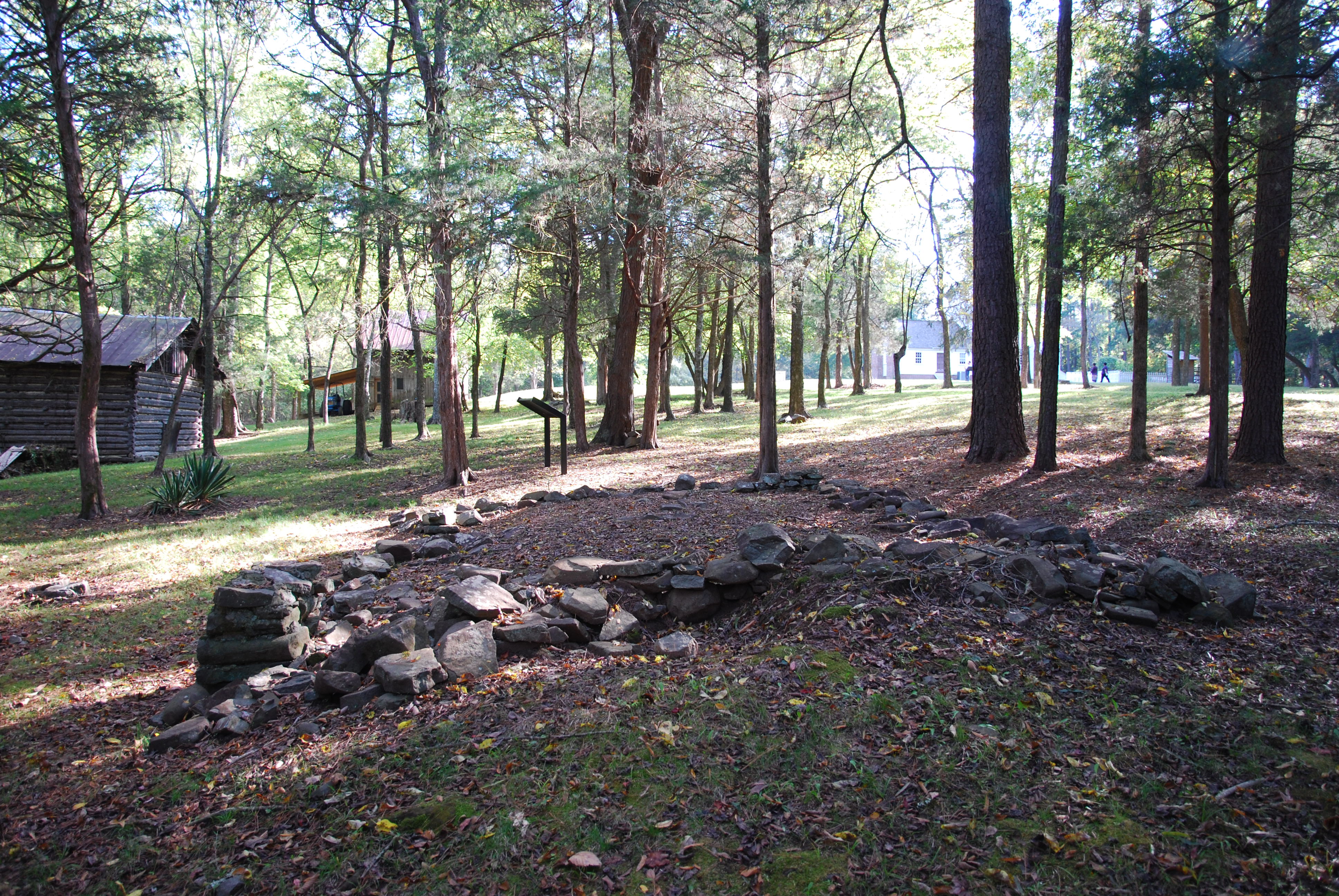
The most extensive excavations focused on a site associated closely with Stagville’s plantation past and the enslavement of many of the people who lived there. A brief undated memorandum describes the structures to be built along with Richard Bennehan’s dwelling house. It includes a pair of buildings described only as “2 Cabins Log Bodys with Cabins Ruffs.” One of the research questions guiding the excavation of the “Slave Cabin” was whether it could be one of those two log structures with “cabin” roofs, thus dating back to the earliest period of Stagville’s history.
The “Slave Cabin” at Stagville stood approximately 180 feet from the back door of the Bennehan family’s dwelling house. One of a line of outbuildings, including other dwellings, the small (19 by 23 feet) quarter structure was near the end of a short path downslope from the main house. When archaeologists encountered it, the drylaid stone foundation was still topped by boards and beams from the demolition that took place only a few decades before. Soil probes at 2.5 foot intervals allowed archaeologists to locate buried stonework, for example, a possible rock-bordered path on the west site of the house. The footprint of the house consisted of four to six courses of stone in a contiguous foundation, except for on the east site, where excavators found stone footings, interpreted as a porch. The chimney base of stone and brick is built into the north wall of the foundation. With the exception of a few repairs, the stone is all dry laid. It is set on a layer of hard red clay containing whiteware and cut nails, leading the archaeologists to conclude that the structure must post-date 1820. It is therefore not one of Bennehan’s original structures.
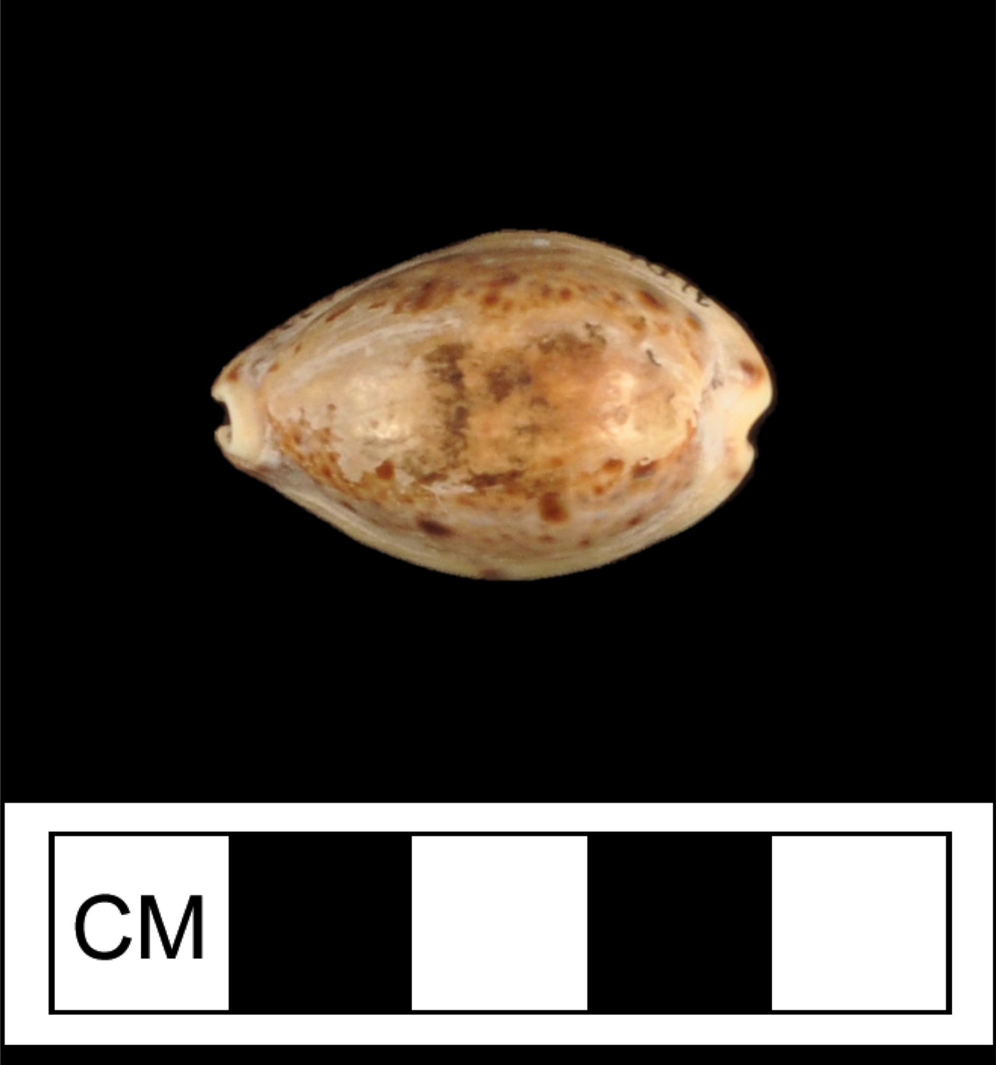
The majority of the ceramic fragments were whiteware sherds, but a significant number of 18th century wares also appeared. Window glass fragments clustered along the west and south walls, suggesting the location of windows. Highlighted artifacts include a number of personal items (pipes, buttons and buckles, and a cowrie shell).
Archaeology at Stagville Today
Nearly all of the intensive archaeological study at Stagville over the years has focused on understanding the lived experiences of enslaved people. This work took place very early in the development of what many now call African diaspora archaeology. The archaeologists emphasized explicitly the need to study “the complex network of human interactions that took place” using sources besides texts created by slave-owning elites and institutions.
Recently, archaeologists from the Research Laboratories of Archaeology at the University of North Carolina at Chapel Hill have resumed archaeological research at Stagville. The artifacts and field notes from the “Slave Cabin” excavation are now accessible online, thanks to a re-cataloging project. A soil core survey has helped to determine that bulldozing did not strip all of the original deposits from the area between the Bennehan house and the “Slave Cabin.” Newly discovered activity areas in the fields beyond the Horton Grove house yards appear to date to the years of the quarters’ construction in the 1850s. A technique called LiDAR (for light detection and ranging) allows archaeologists to see through the tree canopy in the wooded portions of the former Bennehan/Cameron lands. This research is helping to identify old landscape features, such as roads and field boundaries, as well as the foundations of structures not previously recorded. Finally, survey north of the Bennehan house may have identified the location of additional outbuildings or dwellings. Archaeology continues to greatly improve our understanding of the lives of enslaved people at Stagville.
Contributor
Anna S. Agbe-Davies (Department of Anthropology and Research Laboratories of Archaeology, University of North Carolina at Chapel Hill)
*Images courtesy of Anna S. Agbe-Davies.
** Image credit: J. Eric Deetz.
Sources
Anderson, Jean Bradley
1985 • Piedmont Plantation: The Bennehan-Cameron Family and Lands in North Carolina. Historic Preservation Society of Durham, Durham, North Carolina.
Cameron Family Papers
1757-1978 • Southern Historical Collection, Wilson Library, University of North Carolina, Chapel Hill.
Lounsbury, Carl., and George. W. McDaniel
1980 • Recording Plantation Communities: Report on the Architectural and Historic Resources at Stagville. North Carolina Collection, University of North Carolina, Chapel Hill.
McLearen, Douglas C.
1977 • Archaeological Reconnaissance and Intensive Testing of Endangered Areas of the Stagville Center, Durham County, North Carolina. Report on file, Office of State Archaeology, North Carolina Department of Natural and Cultural Resources, Raleigh.
Nathans, Sydney
2017 • A Mind to Stay: White Plantation, Black Homeland. Harvard University Press, Cambridge, Massachusetts.