
Barber Creek (Pitt County)
Barber Creek (31PT259) is an early, stratified site that has been excavated by East Carolina University. It is located near the confluence of the Tar River and Barber Creek, hence where the site name comes from. Archaeologists have done extensive shovel testing at the site, as well as about 250 m2 of unit excavations. Based on this, we know that Barber Creek is a site that has both Woodland and Archaic components. Radiocarbon dates also support the interpretation of an Archaic component.
History of Excavations
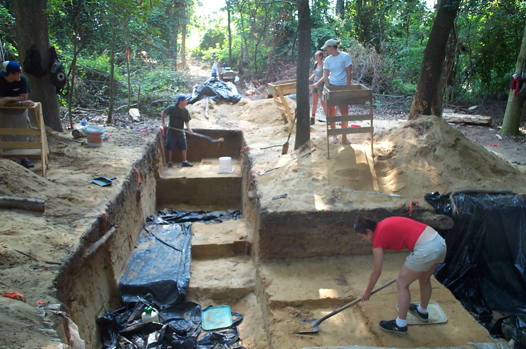
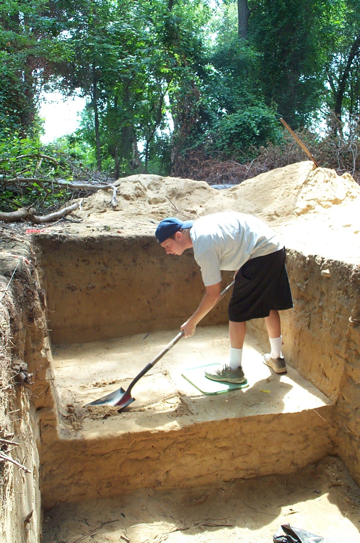
The Barber Creek site was recorded in 1976 by East Carolina University as part of an archaeological survey near Greenville, North Carolina. Limited digging at that time indicated the presence of a nearly a 1 m (3.3 ft) deep deposit of stratified archaeological remains spanning several millennia. These remains primarily included stone and ceramic artifacts in a sand ridge along Barber Creek near its confluence with the Tar River. No further work was done at the site until East Carolina University returned to conduct a series of archaeological field schools from 2000 – 2008. This work was part of a long term project locating and excavating archaeological sites on a portion of the river that winds through Pitt and Edgecombe counties.
The goal of this work is to fill a void in our knowledge about the Coastal Plain’s earliest inhabitants. Several questions underlie the project. First, where are sites located along the river? Second, how long ago were these sites occupied? Third, how were these sites formed? To date we have located over 20 archaeological sites along the Pitt-Edgecombe county stretch of the river. In some places the archaeological remains are rather ephemeral. But in other spots we have discovered locations that were intermittently occupied for several thousand years. Within the latter group, two sites in particular have been the focus of several seasons of excavations including Squires Ridge in Edgecombe County and Barber Creek in Pitt County. Both sites contain archaeological deposits that have accumulated in layer cake-like fashion ranging between about 11,500 – 3000 years ago.
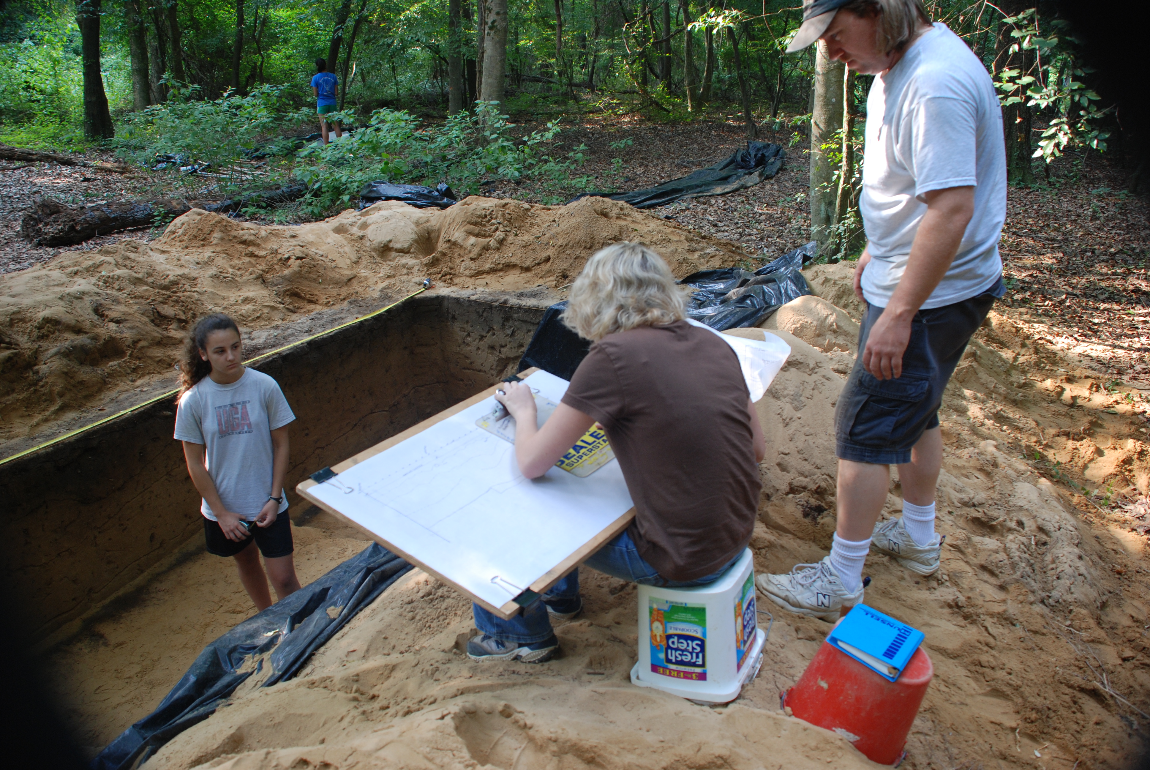
Here we present an overview of the work done at Barber Creek. The site is situated on a sand ridge that parallels Barber Creek for over 100 m (328 ft) covering about 1 ha (2.5 ac) near its confluence with the Tar River. Topographically, this northwest-southeast trending landform rises 2 m (6.6 ft) above the Tar floodplain north of Barber Creek. The site is heavily wooded and with the exception of a canal that cuts through the site’s eastern edge, it has experienced little, if any, modern disturbance. A final report on the site is not yet completed but interim reports on the excavations have appeared in several journal articles, student MA theses, and one PhD dissertation.
Stratigraphy

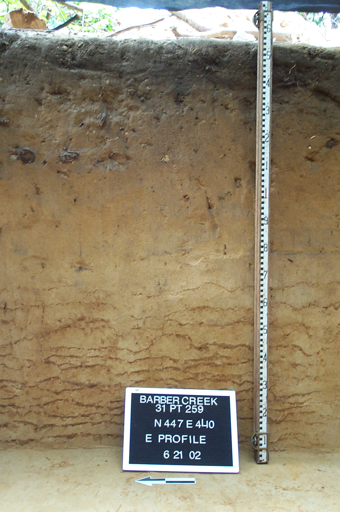
The significance of Barber Creek lies in its stratigraphy. Several millennia of intermittent occupations are preserved at the site, allowing archaeologists to identify the early prehistoric chronology of the region. An understanding of the occupational sequence at Barber Creek, however, requires an understanding of the geological processes that formed the sand ridge. Data gathered from archaeological and geological research at Barber Creek indicate that sand has built up over many millennia—burying successive layers of artifacts in stratigraphic zones. Evidence of intermittent occupations are revealed through detailed archaeological and geoarchaeological fieldwork including plotting the exact position of artifacts, refitting studies, sedimentology, and dating. This work has shown that multiple occupation surfaces are contained within the upper 1 meter (3.3 ft) of sand at Barber Creek with thin zones between occupations that contain few if any artifacts.
Dating of these sediments and associated artifacts at Barber Creek with the use of optically stimulated luminescence and radiocarbon dating (discussed below) suggest periods of landform stability and human occupation followed by periods of instability and burial of occupation zones by sand. Research at Barber Creek and elsewhere on the Tar River indicate that artifacts are buried during short periods of rapid climate change called Bond Events. Bond Events typically manifest as periods of mega-drought, cooler temperatures, occur on millennial time-scales, and last for a few centuries. These extreme climate conditions would have caused destabilization of the local environment, increased fire, desiccation of local vegetation, and freeing up of sand. This sand would then be blown by prevailing winds from exposed point-bars and floodplains onto the Barber Creek landform and accumulate. In fact, examination of sediments at Barber Creek have indicated that the primary mechanism for artifact burial is from wind-blown sediments, most likely from point-bar and flood sediments deposited episodically in the Tar River floodplain and then later reworked by strong prevailing winds.
Large flood events that overtopped the Barber Creek landform also likely contributed sands that buried cultural occupations in layer-cake fashion. Thus the Barber Creek site is best understood geologically as a “source-bordering” linear dune or sand-sheet with contributions from large-scale mega-flood events. Underlying the dune deposits and archaeology are braided river sands and gravels deposited during the last ice-age. Landforms such as Barber Creek are important because they preserve a record of human occupation along the Tar River and allow for reconstruction of geological processes, climatological conditions, and cultural adaptations over many thousands of years.
Dating
One of the important contributions of the work at Barber Creek is that we have obtained a series of absolute dates from the site including both radiocarbon and optically stimulated luminescence dates. Radiocarbon dates are widely used in archaeology and at Barber Creek were obtained on pieces of charcoal and burned nutshell to date various levels in the site. Radiocarbon dating is based on the fact that all living organisms contain a form of carbon (carbon-14) that decays at a steady rate once the organism dies. In short, the remaining amount of carbon 14 can be measured in a sample and the less carbon-14 a sample has, the older the date. To date, we have focused on dating the Early Archaic levels at the site and we have obtained several radiocarbon dates spanning 10,000 – 11,000 years ago. These dates are consistent with the beginning of the Early Archaic period elsewhere in the Southeast.
In some levels of the site, however, organic material is absent so we use another dating method referred to as Optically Stimulated Luminescence (OSL). OSL is a relatively new dating technique that dates certain types of sediments. Sediments (like sand) with quartz grains are particularly well-suited for OSL dating. Thus, Barber Creek is an ideal site to undertake OSL dating. Quartz grains in sand serve as natural clocks because the longer they are buried the more natural radiation they store from their surroundings. The amount of radiation accumulated in a sample provides a measure of time since a former sandy surface was buried and a corresponding date for the artifacts recovered from that level. At Barber Creek, we carefully removed soil samples from various levels of the site to not only date the various occupations but also from deeper levels of the site to date the origins of the sand ridge. These results suggest the ridge started forming about 15,000 years ago. OSL dates from the Early Archaic levels of the site are consistent with the above mentioned radiocarbon dates.
Artifact Typology
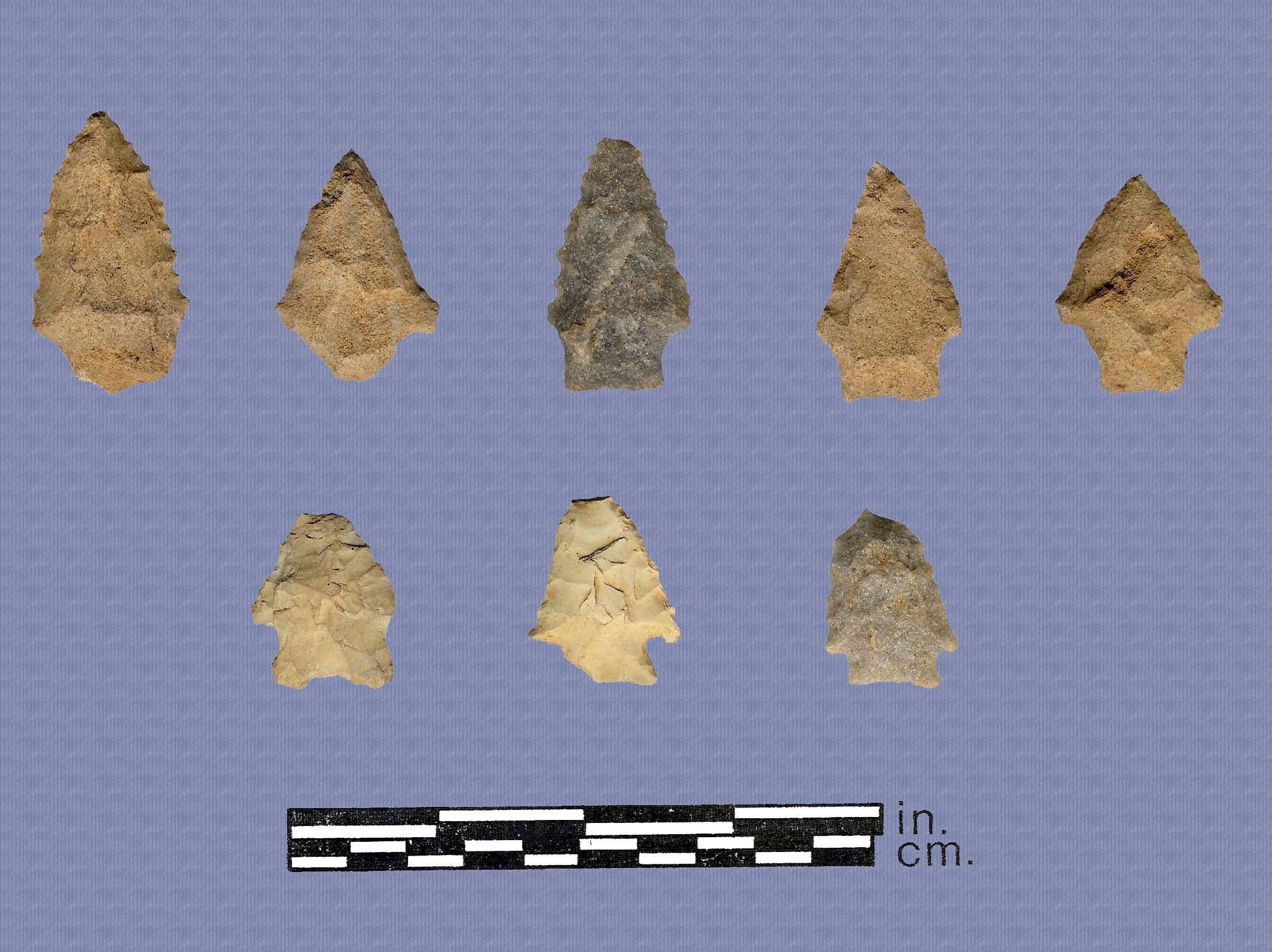
Given that Barber Creek was intermittently occupied for several thousand years, we can document certain changes in artifact styles over time. Our data consists largely of stone tools such as spear and arrow points and a few cutting and scraping tools. Hammerstones in the form of large cobbles and manufacturing debris from stone tool production are also common. Pottery sherds are prevalent as well in the upper site levels. Small spear points are particularly diagnostic indicators of time periods. At Barber Creek we have recovered several projectile point types that span the early prehistory of the region. The earliest point types at the site are referred to as Palmer Corner-Notched and Kirk Corner-Notched points identified elsewhere in the Southeastern United States and are associated with the Early Archaic period. These are small points with corner-notched bases and triangular and sometimes serrated blades. The latter part of the Early Archaic is also represented at the site with another corner-notched point type with a bifurcated base referred to as St. Albans named for the site in West Virginia.
Middle Archaic point types are also well represented at Barber Creek including a series of points with varying stem shapes including Kirk Stemmed, Morrow Mountain Stemmed, and Guilford Lanceolate. Kirk Stemmed points exhibit a small square stem and a triangular somewhat serrated blade. Morrow Mountain Stemmed points are distinguished by stems that taper to a rounded point. Blades can be relatively long and narrow (almost parallel-sided) to short and triangular. Guilford points are somewhat spike-like in shape exhibiting a narrow blade with a lenticular and relatively thick cross-section. All these point types are consistent with those found in the Piedmont.
Savannah River Stemmed points denote the Late Archaic at Barber Creek. Savannah River points are named for the river along which they were initially discovered decades ago. In the Piedmont they are typically identified based upon their large broad-bladed forms with wide shoulders and a broad stem. The same form can be found along the Tar River, however, they are typically smaller in size than those in the Piedmont probably due to the difference in stone type that was used to produce the points in the Coastal Plain (quartz) versus the Piedmont (metavolcanic stone). Another Late Archaic form called Thelma Stemmed marks the transition from the Archaic to the Woodland period at Barber Creek. It is a small stemmed point that appears to represent the evolution to unstemmed triangular points that mark the technological transition to the use of the bow and arrow in North Carolina.
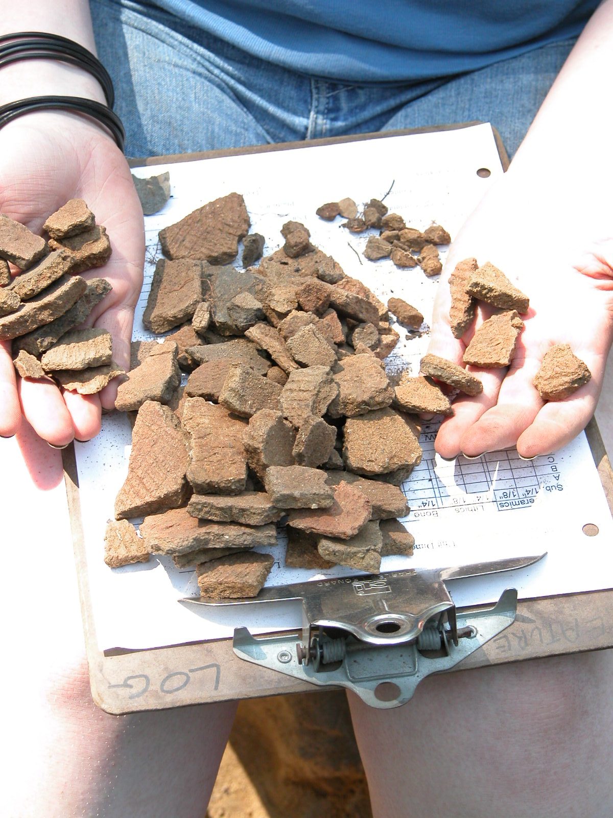
Small triangular points are associated with the first presence of pottery at Barber Creek that usher in the Woodland Period in the region. We don’t yet have firm dates on its first appearance along the Tar but estimate its presence by about 3,000 years ago. Pottery fragments from Barber Creek were parts of large cone-shaped vessels used for cooking and storage. They were made by hand-coiling strips of clay with added sand followed by stamping the exterior pot surface with a paddle to bind the coils together prior to firing. Most of the pottery sherds exhibit cord marked exterior surfaces but lesser frequencies of fabric-impressed and net-impressed sherds are also present.
Site Function
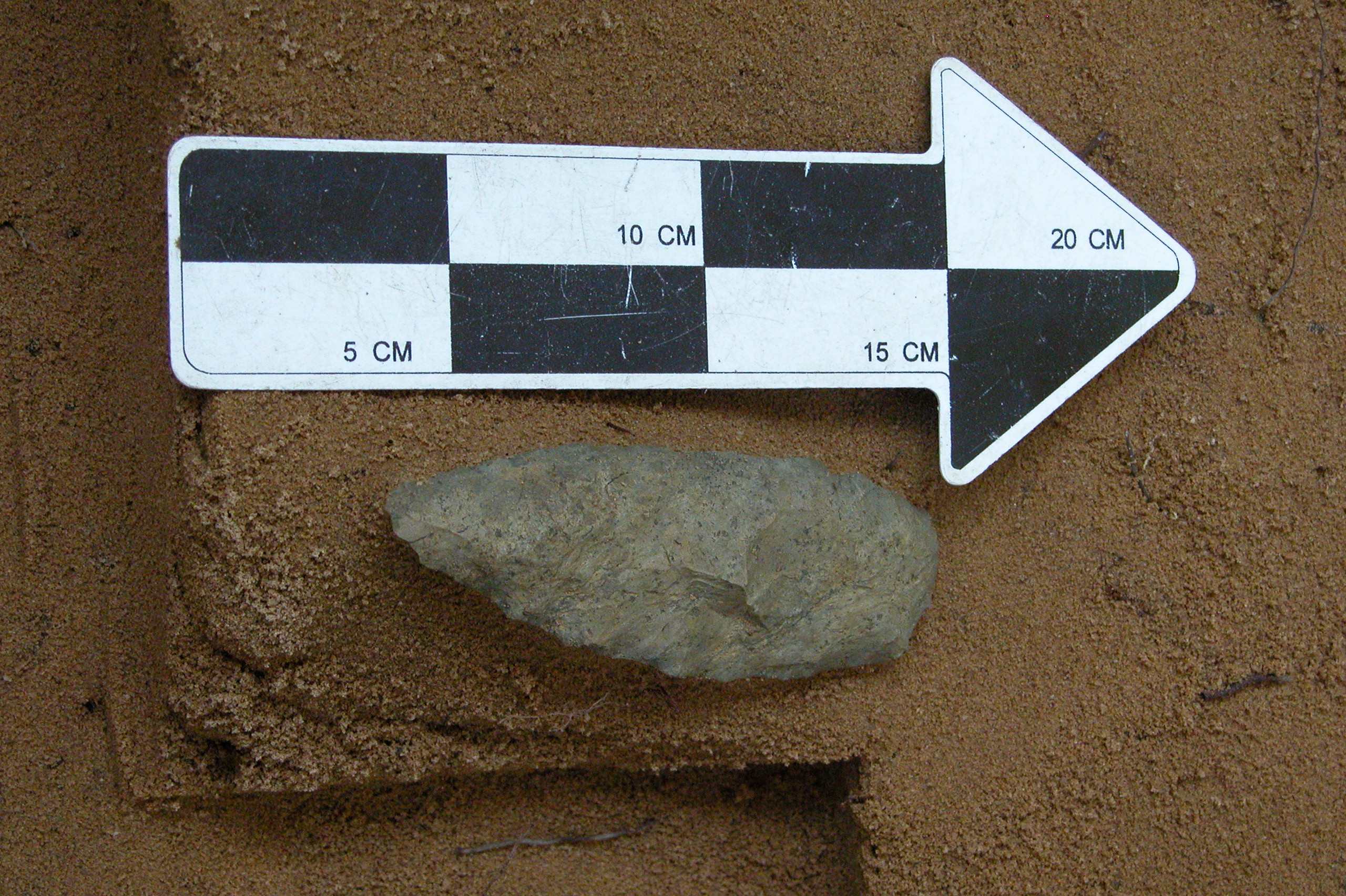
While the primary questions of our study have focused on understanding the prehistoric chronology and artifact typology of the region, our data also provide some clues as to why Barber Creek was a focus of habitation for much of the region’s prehistory. In particular, it appears that small quartz cobbles were procured from the river and used as raw material to make tools and weapons. Broken and unfinished stone tools and the stone waste from tool production are prevalent in the recovered artifacts. In fact, cobble procurement appears to have taken place throughout the history of the site’s occupation. Abundant sources of good tool stone are not particularly common in the Coastal Plain and certain places along the Tar River may have provided predictable sources of useable stone.
Of course, the occupation of the site also likely included exploiting food resources associated with the river. Unfortunately, the sandy soils of the site are not conducive to the preservation of organic materials like plant and animal remains. Nevertheless, we do occasionally find tiny bits of burned animal bone and nut shell. These likely represent food remains consumed by the site inhabitants as they resided along the river.
Much additional work remains to be done to understand the nature of the site occupation, but as elsewhere in the Southeast at this time, we surmise that during the Archaic period the inhabitants of the Tar River were living in small family groups practicing a nomadic hunting and gathering way of life moving in response to the seasonal availability of resources. More sedentary occupations began to emerge with the cultivation of some wild plants during the Woodland period but the degree to which this is applicable to the Coastal Plain remains to be seen.
Conclusions
Excavations at Barber Creek and other sites like Squires Ridge along the Tar River are, as yet, unique in the North Carolina Coastal Plain. The archaeological sequences identified there are beginning to fill a gap in our understanding of the prehistoric chronology and associated artifact typologies for the region. The absolute dates we are obtaining from these sites are also a first for the region. Based on the results thus far, it is clear that sites like Barber Creek and Squires Ridge have archaeological remains that are critical to our understanding the early prehistory of the Coastal Plain. As such, the excavations along the Tar River valley will play a seminal role in the archaeology of the region for some time to come.
Contributors
I. Randolph Daniel, Jr. (Dept of Anthropology, East Carolina University)
Christopher R. Moore (Savannah River Archaeological Research Program, SCIAA, University of South Carolina)
Further Reading
Daniel, I. Randolph, Jr.
2002 • Stratified Early-Middle Holocene Remains in the North Carolina Coastal Plain. Southeastern Archaeological Conference Special Publication 7:6-11.
Daniel, I. Randolph, Jr. and Christopher R. Moore
2011 • Current Research into the Paleoindian and Archaic Periods in the North Carolina Coastal Plain. In The Archaeology of North Carolina: Three Archaeological Symposia. North Carolina Archaeological Council Publication Number 30:3-1 – 3-24.
Daniel, Jr., I. Randolph, Keith C. Seramur, Tara L. Potts, and Matthew W. Jorgenson
2008 • Searching a Sand Dune: Shovel Testing the Barber Creek Site. North Carolina Archaeology 57:50-77.
Moore, Christopher R.
2009 • Late Quaternary Geoarchaeology and Geochronology of Stratified Aeolian Deposits, Tar River, North Carolina. Unpublished PhD. Dissertation, East Carolina University.
Moore, Christopher R. and I. Randolph Daniel, Jr.
2011 • Geoarchaeological Investigations of Stratified Sand Ridges Along the Tar River, North Carolina. The Archaeology of North Carolina: Three Archaeological Symposia. North Carolina Archaeological Council Publication Number 30:1-1 – 1-42.