
Squires Ridge
Since 2000, East Carolina University has been conducting archaeological work locating and excavating archaeological sites on a portion of the Tar River that winds through Pitt and Edgecombe counties in northeastern North Carolina. The goal of this work is to fill a void in our knowledge about the Coastal Plain’s earliest inhabitants. Several questions underlie this project. First, where are sites located along the river? Second, how long ago were these sites occupied? Third, how were these sites formed? To date we have located over 20 archaeological sites along the Pitt-Edgecombe county stretch of the river. In some places people only settled for a short amount of time, leaving behind relatively little in the way of archaeological remains. But in other spots we have discovered locations that were intermittently occupied for several thousand years. Within the latter group, two sites in particular have been the focus of several seasons of excavations: Squires Ridge in Edgecombe County and Barber Creek in Pitt County.
History of Excavations
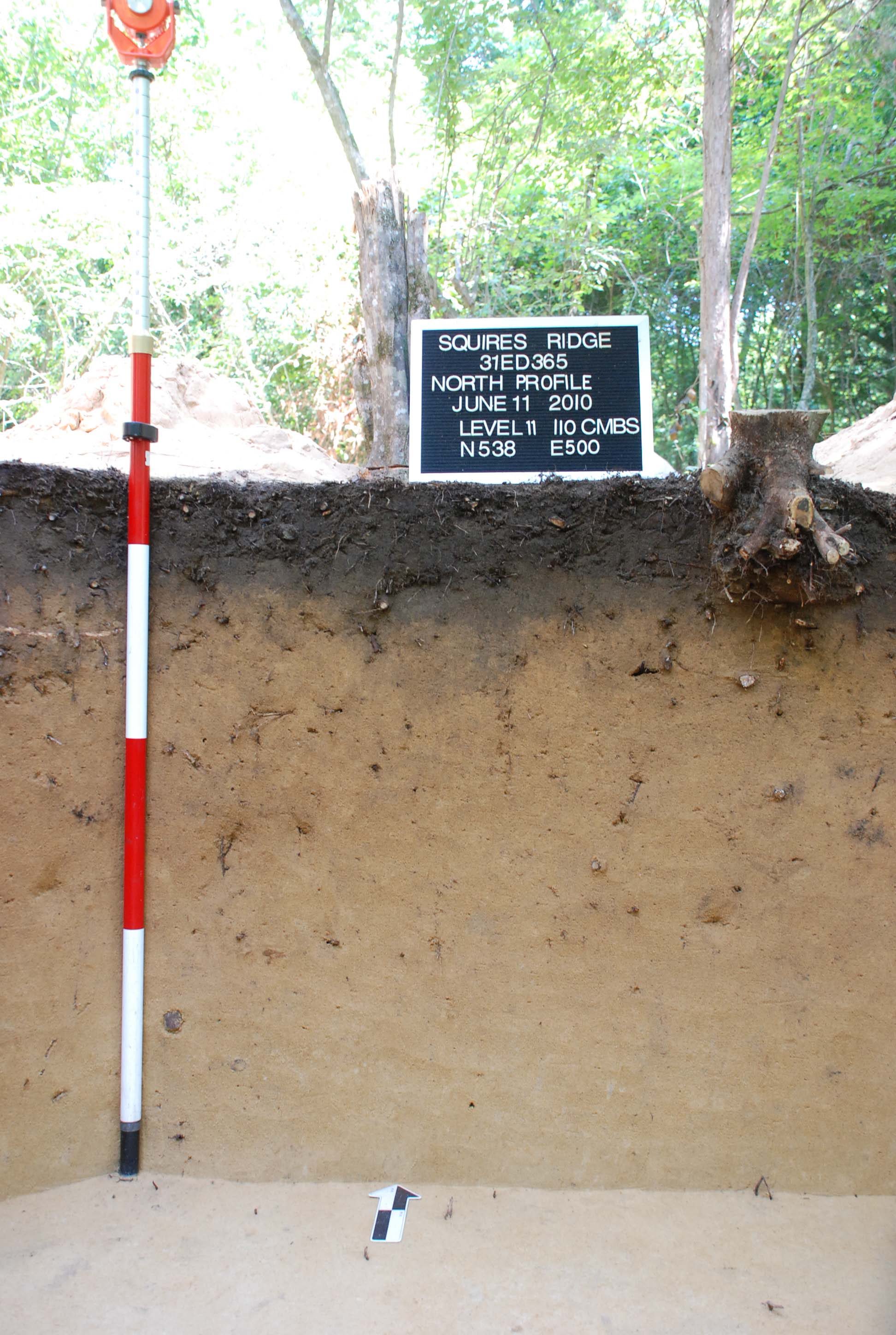
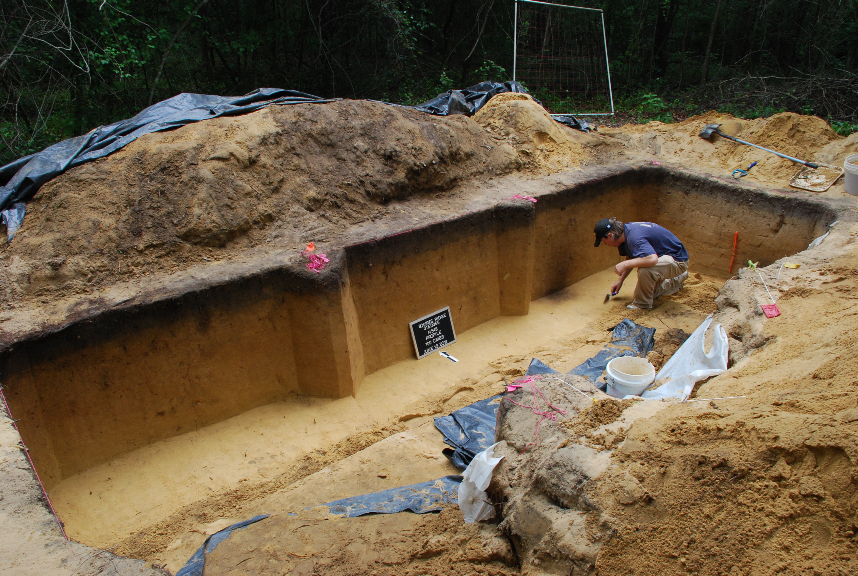
Squires Ridge is located on a narrow sand ridge about 11 m (33 ft) above the Tar River floodplain near where it meets with Lancaster Creek. Mapping and initial excavations in 2009 suggested that the site contained archaeological remains that could address the questions noted above. Additional excavations were conducted from 2010–2012. Here we present an overview of the work done at Squires Ridge focusing on one trench excavation. A final report on the site is not yet completed but interim reports on the excavations have appeared in journal articles, student MA theses, and one PhD dissertation.
Excavation Methods
We applied the geological principle of superposition—undisturbed deposits deeper in the ground are generally older than materials above them—to make sense of the stratigraphy at Squires Ridge. That said, sandy sites present certain challenges in terms of figuring out who lived when. For one, the soil on the ridge is a deposit of sand that lacks the obvious visual changes in color or texture that archaeologists normally use as indications of change over time. For another, sandy soils are somewhat loose, meaning that tree roots and animal and insect burrowing can move artifacts up and down the soil profile. This means that older artifacts can move up into more recent soil layers and more recent artifacts can move down into older soil layers.
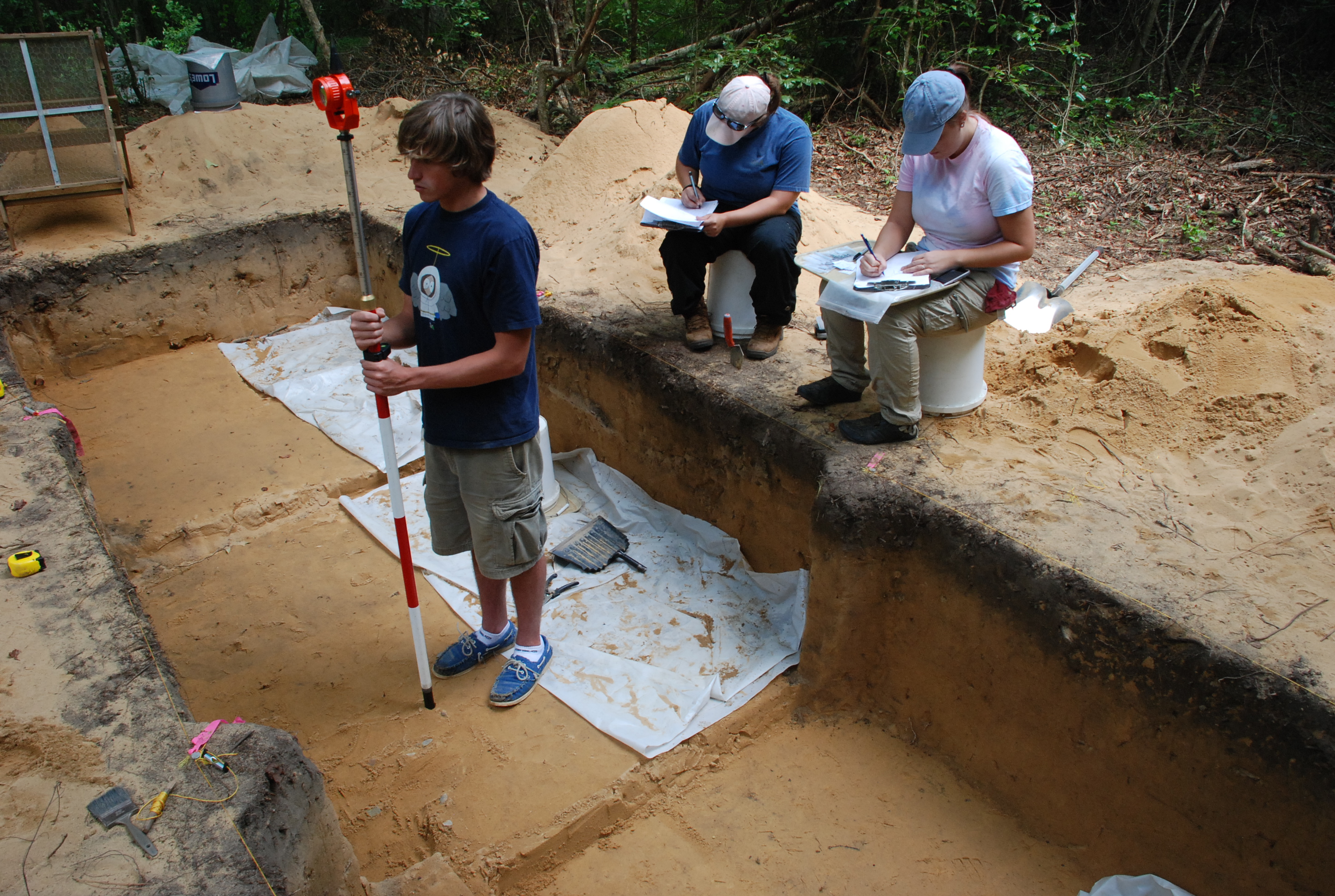
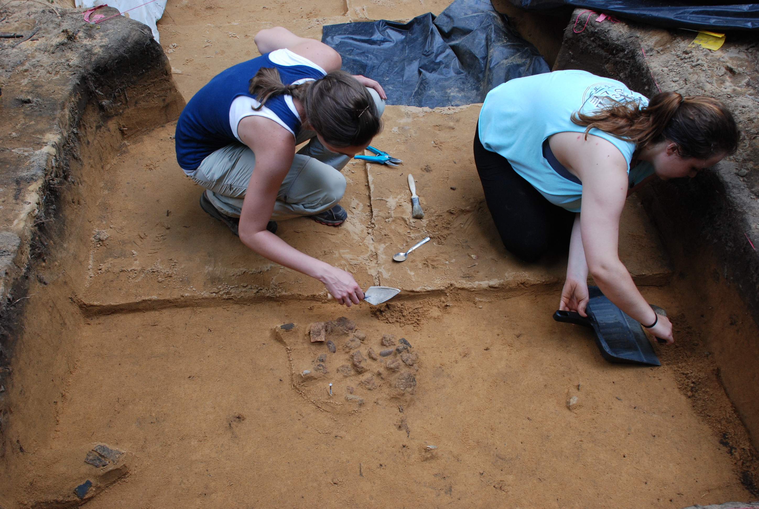
Nevertheless, archaeologists can still figure out the stratigraphic sequence – or order of soil layers – through careful excavation and analysis. Excavation methods at Squires Ridge focused on longer, hand-excavated trenches that were often divided into 1 m (3.3 ft) subunits for greater horizontal control. Particular emphasis was given to piece-plotting (i.e., plotting the horizontal and vertical location) of diagnostic points and relatively large (i.e., 2.5 cm/1 in) artifacts. These objects help archaeologists to detect potentially buried occupation surfaces that cannot obviously be seen in the sand. This type of detailed mapping assumes that larger artifacts are less likely to move up or down the soil profile and that mapping their below surface depths could reveal former “occupation surfaces” (any surface that has evidence for being used as a camp or house area). General excavation fill was screened through 1/8 in hardware cloth and recovered artifacts were bagged by 10 cm (3.9 in) arbitrary levels. Splitting the larger soil layers into 10 cm levels provides another way to understand the vertical accumulation of archaeological material. In this manner, archaeological materials including diagnostic Woodland (1000 B.C.–c.A.D. 1600) and Archaic (8000–1000 B.C.) age artifacts were found to a depth of about 90 centimeters below the ground surface.
Stratigraphy
Understanding the stratigraphy at Squires Ridge requires understanding the geological processes that formed the sand ridge. Sediment analysis suggests that the sandy deposits at Squires Ridge accumulated in a similar manner to those at Barber Creek. In short, this means that the ridges at Squires Ridge were formed of sand brought in by a mix of wind and flood deposits. As the sand accumulated, it continuously buried archaeological remains from about 11500–3000 years ago.
Because the archaeological sequence is generally intact, our analysis focused on identifying the number and age of the archaeological occupations at Squires Ridge. This was done by analyzing the types of artifacts present and their vertical and horizontal placement in the soil. In the absence of the soil color changes normally used by archaeologists to help locate cultural soil layers, three methods were used to figure out if the stratigraphy (soil layers) were appropriately intact and to identify former occupation levels. The three methods included: 1) looking for patterns in the distribution of total artifacts by level; 2) correlating artifact “backplots” (described below) with radiocarbon dates; and 3) examining the spatial locations of artifacts, including those associated with artifact refitting.
Method 1: Artifact Frequency Distribution by 10 cm Level
Artifact frequency distribution is a type of analysis where artifacts are totalled by type, the type totals are standardized (for example by volume of soil excavated), and the resulting frequencies for each level are then compared. Cumulative artifact frequency by level revealed two patterns at Squires Ridge. First, we found a bimodal distribution (two peaks) with artifact peaks occurring in Level 3 (20–30 centimeters or about 8–12 inches below surface) and Level 8 (70–80 centimeters or about 28–32 inches below surface). Second, while lithic artifacts are present throughout all levels, ceramics are limited to Levels 1–4 (0–40 centimeters or about 0–16 inches below surface). Ceramics peak in Level 3, clearly indicating a stratigraphic difference in ceramic (i.e., Woodland) and preceramic (i.e., Archaic) components at Squires Ridge. The two frequency distribution peaks tend to correspond with the two artifact backplot distributions discussed below.
Method 2: Artifact Backplots and Radiocarbon Dates
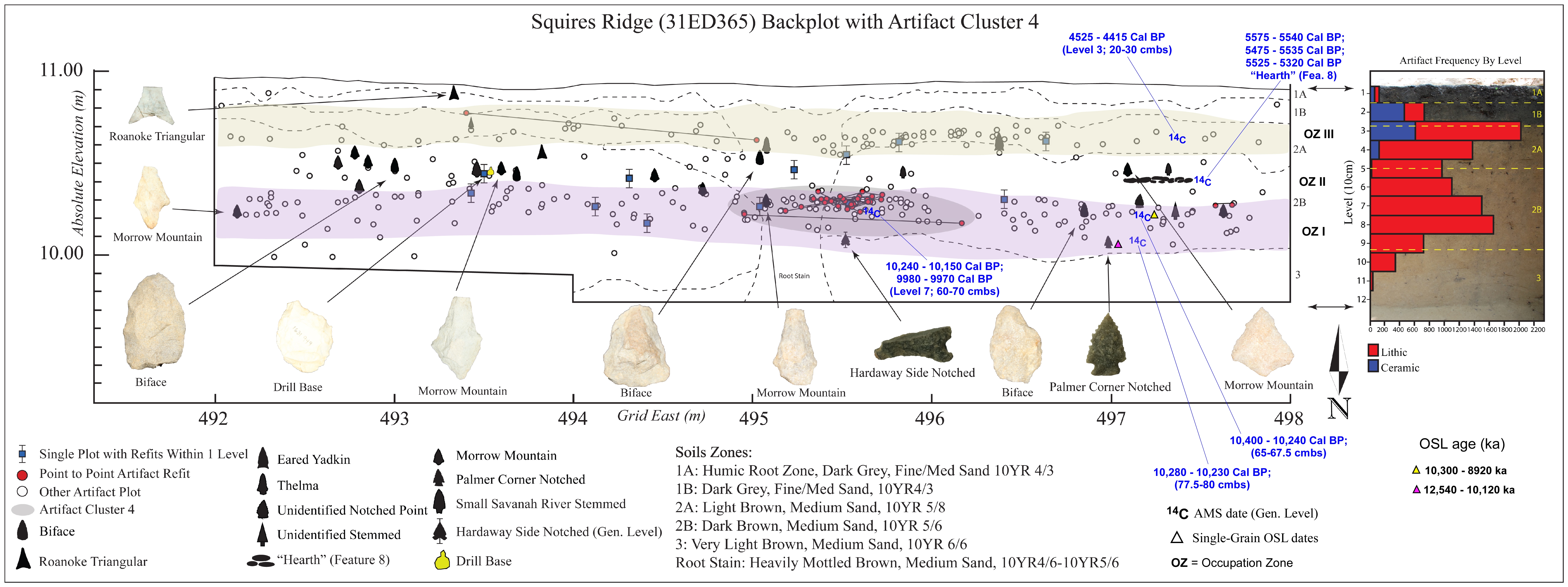
Artifact backplots include marking the vertical and horizontal location of piece-plotted artifacts on a trench profile, creating something akin to a scatterplot of artifact distributions across the trench. Projectile points are of particular importance in interpreting artifact backplots because they are relatively sensitive indicators of time. As such their vertical location on a backplot could potentially identify the locations of former occupation surfaces. A total of 22 projectile points, including Archaic and Woodland types, were recovered from trench excavations. In addition, artifact backplots were correlated with radiocarbon dates (discussed below) taken from small pieces of charcoal recovered at various levels during the excavation. While artifact backplots showed a continuous distribution down the soil profile, artifact clustering is present within the profile that tends to correspond to the peak frequency distributions noted above. One backplot cluster occurs in Levels 6–8 (50–80 centimeters or 20–32 inches below surface) while the second occurs in Levels 2–4 (10–40 centimeters or 4–16 inches below surface).
Method 3: Artifact Clusters & Refitting

Apparent horizontal spatial clustering of artifacts was observed during excavation and are consistent with the levels of occupation zones described above. Much of this clustering was in the form of stone flaking debris, broken chipped stone artifacts, or pottery sherds that represent either unfinished manufacture rejects or tools broken and discarded presumably because they were no longer useful. Numerous artifact refits were identified among the manufacturing debris, particularly lithic and ceramic refits. Refits simply means that the artifacts can be pieced back together. With ceramics, broken pieces of pots are joined back together; tracking the vertical and horizontal placement of the refitted fragments helps us to understand the cultural and/or natural processes that may have moved the broken pieces. With lithic refits, as a piece of stone is worked by a person, flakes and shatter are removed. As with ceramics, tracking the location of these fragments can help archaeologists understand whether there has been very little or a lot of artifact movement after they were initially left on the ground. With respect to site integrity at Squires Ridge, it is noteworthy that piece plotted refits on average were only separated vertically by 3.5 cm (1.4 inches) of soil, suggesting very little soil mixing after they were discarded. Of particular interest also are two spatial artifact clusters—Artifact Cluster 4 and Feature 8—described below.
Artifact Cluster 4
Artifact Cluster 4 contained at least 75 plotted stone artifacts concentrated in a one meter square at about 62.5 centimeters (24 inches) below surface. This cluster is associated with the upper portion of Occupation Zone 1 (discussed below). Artifacts include cobble fragments (n=9), flaked cobbles (n=3), and single examples of a broken cobble, pebble, and a biface fragment. The remaining artifacts are all flaking debris. Preliminary attempts at refitting showed at least three partially complete cobbles, one of which includes five refitted artifacts. This cluster is tentatively interpreted as a cobble flaking feature.
Feature 8
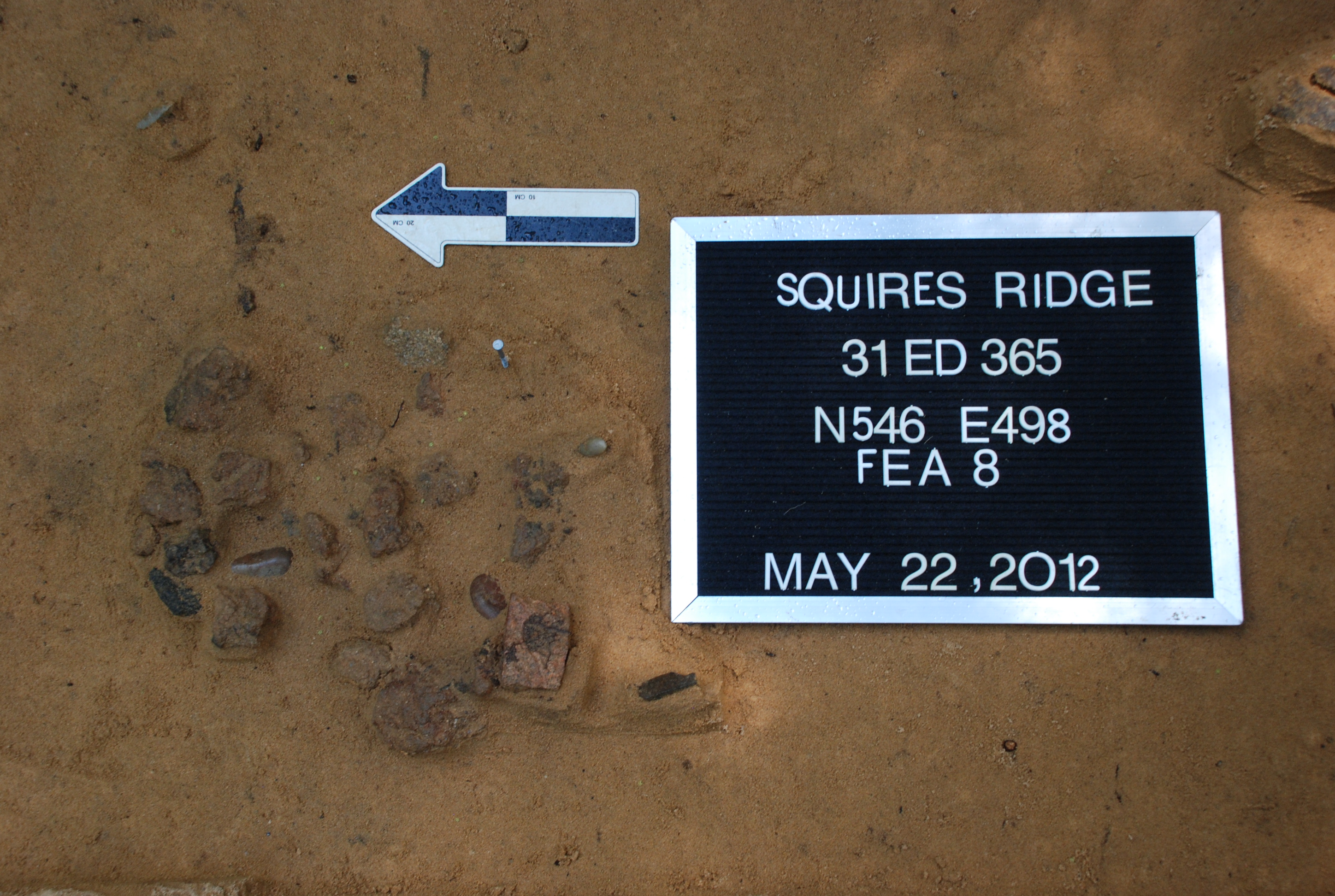
Feature 8 consists of about 30 small (golf ball size) stone chunks and three small cobbles tightly clustered in an area about 30 x 40 centimeters (12–16 inches) in size and located about 45.5 centimeters (18 inches) below surface. The stone chunks have a reddish color on their surface as if they were burnt. Abundant charcoal flecking was present in the matrix surrounding the stone chunks, which is the material that would be left behind after wood is burned. This feature is associated with Occupation Zone 2 (discussed below) and is tentatively interpreted as a former hearth.
Discussion
Three occupation zones were identified based on the above analysis. The term occupation zone refers to a soil layer of varying thickness accumulating over a period of time (either rapidly or slowly) that roughly corresponds to a former occupation surface and can be correlated with an archaeological time period.
Occupation Zone 1
Occupation Zone 1 is identified based upon a peak in artifact densities in Levels 7 and 8 and accompanied by the high number of artifact back plots in the same levels. This zone also contains Artifact Cluster 4—the cobble flaking feature containing multiple artifact refits. While the presence of an occupation zone at this depth is fairly clear, its cultural historical association (dating) is less certain. This uncertainty is due to the presence of both Middle Archaic (e.g., Morrow Mountain) and Early Archaic points (Palmer Corner-Notched and Hardaway Side-Notched points). There are a few reasons to think that the Middle Archaic association could be in error, however. The first is that there are several Morrow Mountain (Middle Archaic) points in the levels immediately above Occupation Zone 1, which suggests that the Middle Archaic points found within Occupation Zone 1 may have been displaced downwards. Second, two radiocarbon dates from this zone provide evidence for a Mid to Early Archaic assignment (ca. 8000 B.C.). And third, Hardaway Side-Notched and Palmer Corner-Notched types tend to be associated with the beginning of the Early Archaic, dates that are consistent with the the location of the charcoal that provided the radiocarbon dates. Thus, taking the radiocarbon dates at face value, Occupation Zone 1 extends from about 60 – 90 centimeters (24 – 36 inches) below surface and spans the duration of the Early Archaic period (8000–6000 B.C.).
Occupation Zone 2
Occupation Zone 2 occurs from about 40–60 centimeters (16–24 inches) below surface and is interpreted to span the Middle to Late Archaic periods (6000–1000 B.C.). While this zone doesn’t have the peaks in artifact densities that define the other zones, Zone 2 does contain at least five Morrow Mountain points and two small stemmed points (perhaps Small Savannah River?). Another two point fragments in this zone likely represent Middle Archaic Morrow Mountain points. Perhaps the zone’s most distinctive characteristic is the presence of Feature 8 (mentioned above) and tentatively identified as a hearth rock cluster. Charcoal from this feature yielded a radiocarbon date of about 5500 years ago that falls within the first few centuries of the Late Archaic Period. The relatively low artifact frequencies of Occupation Zone 2 contrasts with the high artifact counts that in the zones above and below, and suggests that not all occupation zones at Squires Ridge are defined based on high artifact densities. Taken together, the relatively low artifact counts and the intact nature of Feature 8 may suggest a period of relatively little occupation on the ridge and/or a period of rapid burial via wind-blown sands.
Occupation Zone 3
Occupation Zone 3 is identified by the second peak in artifact frequencies associated with Level 3. This peak is also associated with the clustering of ceramic artifacts that occurs in Levels 2 and 3 (10–30 centimeters or about 4–12 inches below surface) along with a clustering of lithic and ceramic backplots (including artifact refits) that tend to span Levels 3 and 4 (20–40 centimeters or 8–16 inches below surface). Taken together, the artifact frequencies mean that Levels 2 through 4 are clearly associated with the Woodland component at the site (1000 B.C.–c.A.D. 1600). This component is identified primarily by the presence of Deep Creek ceramics, which represent the Early Woodland (1000–300 B.C.) ceramic series in the North Carolina Coastal Plain, although minor amounts of Middle Woodland (300 B.C. – A.D. 800) ceramics are also present in the form of Hanover and Mt. Pleasant series sherds. Woodland projectile points recovered from Occupation Zone 3 include two Roanoke Triangular points, one eared Yadkin point, and one Thelma Stemmed point.
Conclusions
For the past several decades archaeologists in North Carolina have relied on the stratigraphic sequences found in the Piedmont to frame the prehistoric culture history of the state. The archaeological potential for the presence of stratified sites in the sandy soils of the Coastal Plain have largely been overlooked due to mistaken assumptions about processes of site formation and the degree of artifact mixing that has affected site integrity. However, recent geoarchaeological work such as that at Squires Ridge suggests that stratified sites spanning the Archaic and Woodland periods do exist in the Coastal Plain and they contain archaeological assemblages of some integrity. As such, continued work along the Tar River will likely contribute additional insights into the archaeology of the North Carolina Coastal Plain.
Contributors
Randolph Daniel, Jr. (Department of Anthropology, East Carolina University)
Christopher R. Moore (Savannah River Archaeological Research Program, University of South Carolina)
Terry E. Barbour, II (Department of Anthropology, University of Florida)
Further Reading
Daniel, I. Randolph, Jr. and Christopher R. Moore
2011 • Current Research into the Paleoindian and Archaic Periods in the North Carolina Coastal Plain. In The Archaeology of North Carolina: Three Archaeological Symposia. North Carolina Archaeological Council Publication Number 30:3-1 – 3-24.
Daniel, Jr., I. Randolph, Christopher R. Moore, and E. Christopher Caynor
2013 • Sifting the Sands of Time: Geoarchaeology, Culture Chronology, and Climate Change at Squires Ridge, Northeastern North Carolina. Southeastern Archaeology 32:253-270.
Daniel, Jr., I. Randolph, Christopher R. Moore, and Terry E. Barbour II
2015 • Searching for Stratigraphy in a Sand Dune: Artifact Backplots, Refitting, and Frequency Distributions at Squires Ridge, North Carolina. Poster presented at the 72nd Annual Meeting of the Southeastern Archaeological Conference in Nashville, TN, November 18-21.
Moore, Christopher R.
2009 • Late Quaternary Geoarchaeology and Geochronology of Stratified Aeolian Deposits, Tar River, North Carolina. Unpublished PhD. Dissertation, East Carolina University.
Moore, Christopher R. and I. Randolph Daniel, Jr.
2011 • Geoarchaeological Investigations of Stratified Sand Ridges Along the Tar River, North Carolina. The Archaeology of North Carolina: Three Archaeological Symposia. North Carolina Archaeological Council Publication Number 30:1-1 – 1-42.