
John White Trail: Overview
British NPG 1612
CC BY-NC-ND 3.0
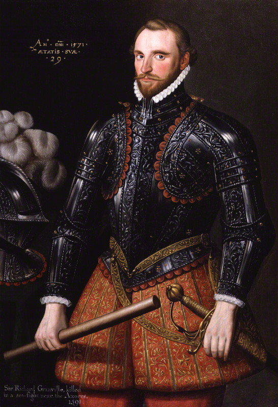
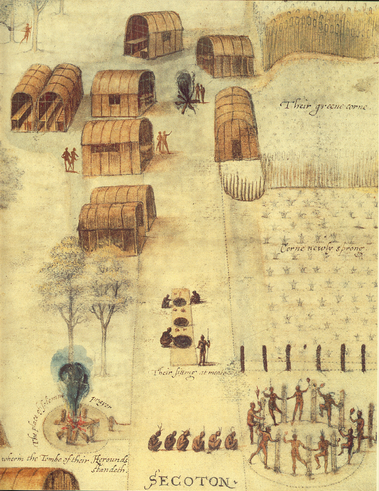
The first attempt to found an English colony in North America happened in 1585 when Sir Ralph Lane led a group of colonists, supported by Sir Walter Raleigh, to Roanoke Island. Among this group was John White, who was sent by Raleigh to be the artist-illustrator for Sir Richard Grenville; he ended up serving as both a mapmaker and an artist for the group. The map produced from explorations by Lane and Grenville, titled La Virginia Pars, was created by White and John Harriot, who provided measurements. That said, while White and Harriot receive credit for the map, it is probable that a team of people was involved in providing numerous detailed surveys and sketches.
The initial foray to North America experience numerous difficulties and most of the colonists left for England in 1586. White was soon asked to organized a new settlement in the Chesapeake Bay area that would include women and children so that it could be self-sustaining. He was able to bring together 113 colonists for this second attempt, including his daughter and son-in-law. The group left England in May of 1587 but unfortunately used the same Portuguese navigator as during the first expedition, Simon Fernandez. When the Lion reached Roanoke in late July of 1587, Fernandez for the colonists to get off the ship and refused to take them to their proposed landing of Chesapeake Bay. This initial experience was a harbinger of things to come, as the colonists were consistently at tension with the local Algonkian Indians. As supplies ran out, White agreed to return to England in late 1587; supply ships had no way of knowing the colonists had been forced to land in Roanoke and would not be visiting to resupply the colony. White’s trip back to England was beset by misfortune and he was only able to land in Ireland in October of 1587. Attempts to get back to Roanoke were delayed by the Spanish Armada and French pirates; it was not until 1590 that White was ultimately able to return. On reaching Roanoke Island on August 18 but found the colony deserted, with the only evidence of those who were left behind the letters “CRO” carved into a tree, and “CROATOAN” carved into one of the fort’s posts.
© Trustees of the British Museum
While North America ended up being unlucky for John White, the map and drawings he produced are an incredibly rich source of information about the Indians that live in North Carolina and Virginia at the time. White’s original map includes the locations of about 25 Indian towns that were inhabited at the time of their explorations; we have chosen 17 located in North Carolina to incorporate into a modern day John White Trail. Accessing the modern trail below or to the left will bring you to a modern map; based on the rough locations of the towns we have created some driving routes and provided suggestions for other heritage attractions in each area. Clicking on the link to the historical map will allow you to see a colored engraving made of White’s map, as well as learn some information about each of the towns we have highlighted.
Please note that many of the towns on John White’s map have not been located. In order to protect the possible locations of sites as well as respect the privacy of landowners, we have not provided their exact locations. As an alternative, we have located placemarkers in nearby towns, cities, or other other historic locales. We hope you understand, enjoy what each area has to offer, and hopefully as more archaeology is done we will be able to add other site visits, displays, and museums to the map!