
Southern Coastal Plain
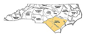 The Southern Coastal Plain extends from just south of the Neuse River basin to the South Carolina state line and covers an area that during Contact was occupied by Siouan-speaking tribes. While the Southern Coastal Plain does not have as much access to estuarine resources as areas to the north, the advantage of the south is better protection against extremes of wind and cold. During the Paleoindian, Archaic, and Woodland, and Contact periods, the archaeology of the Southern Coastal Plain is much like the rest of the Coastal Plain and Coast regions, which is reflected in the content of the Detailed Regional Overview. Minor differentiations between the Northern and Southern regions can be found during the Middle and Late Woodland periods, when differences emerge in ceramic typologies.
The Paleoindian is the time of the earliest generally accepted arrival of people in the southeastern United States – about 16000 years ago, or 14000 B.C. Although earlier migrations of people into the New World have been hypothesized, currently there is no firm evidence of people anywhere on the continental United States prior to 14000 B.C.
Our level of understanding of the Paleoindian period across the state is highly uneven, due to both the history of North Carolina archaeology and environmental and geological factors.
Paleoindian Chronology
Paleoindian in the Southeast is divided into Early, Middle, and Late subperiods.
Spear points of the Early Paleoindian period (14000 – 9000 B.C.) are large, fluted lanceolates, very similar to the classic Clovis points of the West. What we know about the earliest inhabitants of North Carolina is based almost entirely on surface finds of these points. Concentrations of Early Paleoindian points have been noted in the Tennessee, Cumberland, and Ohio River valleys, as well as western South Carolina, southern Virginia, and the northern Piedmont of North Carolina.
In the Middle Paleoindian period (9000 – 8500 B.C.) the number of spear points increases considerably and regional variability in spear point forms emerge. The Cumberland, Suwanee, and Simpson point types are thought to be typical of this period. One thing all have in common is a narrowing or “waisting” at the base.
The Late Paleoindian period (8500 – 7900 B.C.) shows increased population growth. Dalton points are the diagnostic Late Paleoindian point type. By the end of the Paleoindian, Holocene climatic conditions prevailed and the basic hunting and gathering lifeway that persisted for the next 5000 years was set.
Paleoindian Settlement and Subsistence
Paleoindian settlers in the Southeast found a rapidly changing landscape. Current evidence suggests that many of extinctions of Late Pleistocene megafauna – including the horse, mastodon, and mammoth – were complete by 8500 B.C.
East of the Mississippi River almost no Paleoindian tools have been found with these animals. Environmental differences between the Eastern and Western parts of the continent may have necessitated very different adaptations. By the Middle Paleoindian period, if not earlier, the subsistence pattern was probably very similar to that of the Early Archaic period.
Most southeastern Paleoindian sites where more than a single point has been found are related to stone-quarrying activities. This pattern reflects a generalized foraging where groups rarely engaged in subsistence activities that produced recognizable traces in the archaeological record.
Paleoindian on the Coastal Plain and Coast
Ocean levels were lowered by 150 feet or more during the last glacial period. This means that during Paleoindian times the coast was 230 to 300 miles from the Piedmont. Today, the Paleoindian sites from before 10,000 ago near the coast lie submerged; Paleoindian sites found near today’s coast represent adaptations to what was then the central Coastal Plain.
The Coastal Plain probably had deciduous forests dominated by beech and hickory. Climate was cooler and wetter than day, perhaps very similar to the modern climate of New York.
Paleoindian points have been found only sporadically in the Coast and Coastal Plain, with less than fifty sites known. In part this is because the region has not been surveyed as extensively as other regions of North Carolina.
Close Paleoindian
The Archaic (8000 – 1000 B.C.) is an overarching time period covering over half of the time-span people have lived in North Carolina. This vast time has been explored by finding well-preserved deposits in rock-shelters and stratified, deeply-buried open sites in alluvial floodplains. The Archaic is generally thought of as a period dominated by nomadic, relatively small bands pursuing a hunting and gathering way of life, but there is evidence that some Archaic people settled into larger and more permanent sites relatively early.
From the coast to the mountains, the Archaic began with wandering bands of hunters and gatherers who faced a wide variety of changing environmental conditions. These bands occasionally came together at favored locations along major river valleys, but most of their time was spent in small groups scattered across the landscape foraging for food and raw materials.
Toward the end of the Archaic, large groups began to settle down and live most, if not all year in areas rich in raw material and food resources. This settled life spawned the beginnings of plant domestication and use of pottery, hallmarks of the succeeding Woodland.
The Archaic in the Coastal Plain and Coast
Numerous Archaic sites have been discovered on the North Carolina Coastal Plain and Coast. Unlike the Piedmont, where Archaic sites with stratified contexts have been excavated, the Coastal Archaic is known primarily from surface collections.
Diagnostic spear point styles recognized in the Piedmont are duplicated in the artifact collections from the coast.
Archaic sites (base camps and small temporary sites) are widely scattered and can be found nearly anywhere near water. The number of sites generally increased through time. During the Late Archaic period, settlement shifted away from upland tributary streams toward the mouths of major rivers. Here hunting and fishing led to larger and more sedentary camps where pottery making and horticulture began.
Close Archaic
Three interrelated innovations marked the end of the Archaic and the beginning of the Woodland: pottery-making, semi-sedentary villages, and horticulture. All had their origins in the Archaic but became the norm during Woodland times.
The widespread appearance of pottery-making is viewed as going hand in hand with an increasing reliance on seed crops and more permanent settlement. Domestication of early cultigens laid the groundwork for later acceptance of tropical cultigens. Corn was not widely grown until after A.D. 700 and did not become an important food crop in many areas until after A.D. 1000. With the introduction of beans around A.D. 1200, the eastern agricultural triad of corn, beans, and squash was completed.
In North Carolina, the Woodland is divided into Early, Middle, and Late periods. Along the coast and through much of the Piedmont, the Late Woodland continues until Contact, while in the Appalachian Summit, Western Foothills, and the Southern Piedmont, Mississippian and Mississippian-influenced societies developed after A.D. 1000.
The Woodland cultures of the North Carolina Piedmont were only marginally influenced by cultural traditions elsewhere in the eastern United States. The rich and elaborate Hopewell and Swift Creek cultures that influenced wide areas of the Southeast had little impact on cultural developments in the Piedmont. And the powerful Mississippian chiefdoms that later dominate most of the Southeast were only able to penetrate the southern fringe of the Piedmont.
The Woodland Period on the Coast and Coastal Plain
The North Carolina Coastal Plain and Coast are divided into northern and southern parts. In terms of subsistence, the northern region provided far better access to estuarine resources than the south, but the south offered an environment better protected against the extremes of wind and cold.
The Woodland in the Coastal regions of North Carolina was marked by continuity, and the changes that occurred were typically gradual in nature. There were few differences between Late Archaic and Early Woodland cultural traditions and Woodland changes in technology, subsistence, and political organization seem almost imperceptible, reflecting few outside influences. Differences between Middle Woodland and Late Woodland cultural patterns are sharp, but then from A.D. 800 until the first contacts with Europeans was again a period of stability and continuity.
Early Woodland (1000 – 300 B.C.)
Most of what is known about the Early Woodland period in the coastal regions comes from ceramic studies. The earliest ceramics in North Carolina are typologically similar to Late Archaic Stallings-ware pottery of the Georgia and South Carolina coasts.
Antecedents to Early Woodland Pottery
Fiber tempered Late Archaic Stallings Island pottery is found as far north as the Tar and Chowan River drainages, but is generally restricted to south of the Neuse River. In the Middle Atlantic region, the earliest pottery is a steatite-tempered ware called Marcy Creek and similar sherds have occasionally been found north of the Neuse River.
Thom’s Creek pottery, which is generally thought to be roughly contemporaneous with Stallings ware, has only been reported from the Southern Coastal region.
Deep Creek and New River Phases
At the beginning of the Early Woodland period, pottery made with a sand-tempered paste and a cordmarked exterior began to be made throughout the Coastal region.
In the north, this pottery is called the Deep Creek series. The Deep Creek series is related to the Stony Creek series of southern Virginia. Large triangular points similar to the Roanoke Triangular type at the Gaston site are believed to be associated with Deep Creek ceramics.
In the Southern Coastal Plain, the New River pottery series is thought to date to the same time period as Deep Creek. Although the vibrant Early Woodland Deptford ceramic tradition borders New River phase to the south, Deptford influences are not apparent.
Much more information is needed before Deep Creek and New River phases can be firmly defined along the coast.
Middle Woodland (300 B.C. – A.D. 800)
Two Middle Woodland phases have been defined in North Carolina’s coastal regions: Mount Pleasant and Cape Fear. The Cape Fear Phase of the Southern Coastal region presents a more varied picture of Middle Woodland life than Mount Pleasant phase to the north. Two distinct ceramic traditions are found in the south: a grog-tempered series called Hanover (aka “Carteret”) and a sand-tempered series called Cape Fear.
Hanover series vessel surfaces were either stamped with cord-wrapped or fabric-wrapped paddles or smooth. Cape Fear series pottery is similar to Mount Pleasant pottery to the north. Like Hanover pottery, Cape Fear vessels were finished with cord-wrapped or fabric- wrapped paddles.
Sites with Hanover series pottery are widespread in the southern coastal region. They occur on the banks of rivers and creeks that drain into the sounds and along the shorelines of estuaries, inland swamps, and pocosins (shrub bogs).
No evidence of horticulture has yet been found on Middle Woodland sites in this region. Widespread resource use can be presumed, although the sites so far excavated may represent short-term occupations for procuring and processing marine resources.
Only circumstantial evidence for Middle Woodland houses has yet been found. At the Broad Reach site in Carteret County, oval or circular posthole patterns have been uncovered near features associated with Hanover pottery.
Middle Woodland Sand Burial Mounds
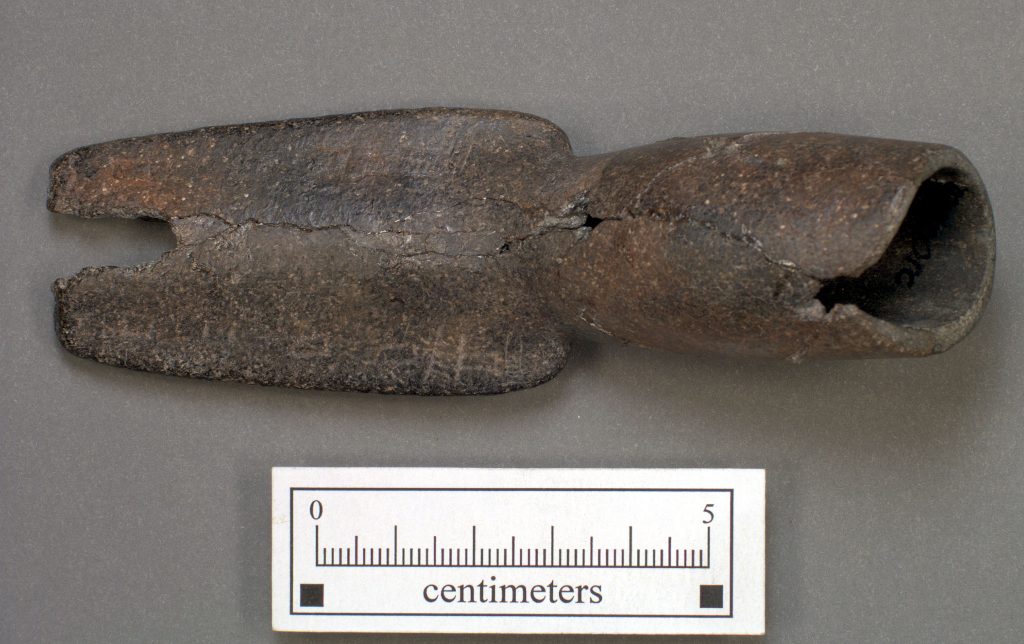
Many of the low, circular, sand mounds containing secondary burials and cremations are found in the southern inner Coastal Plain. The most thoroughly studied sand mound is the McLean Mound, near the Cape Fear River in Cumberland County.
Secondary burials, representing individuals previously placed in a charnal house or scaffold and then buried as bone bundles or in mass graves after decomposition, were found in the McLean Mound. Over three hundred individuals were represented.
Also found in the mound were numerous artifacts thought to be grave offerings. Some were placed with individual bundle burials, while others were randomly scattered through the mound.
Bone and shell beads, chipped-stone and antler arrow points, pottery sherds, animal bones, celts, abrading stones, and paint pigments were found.
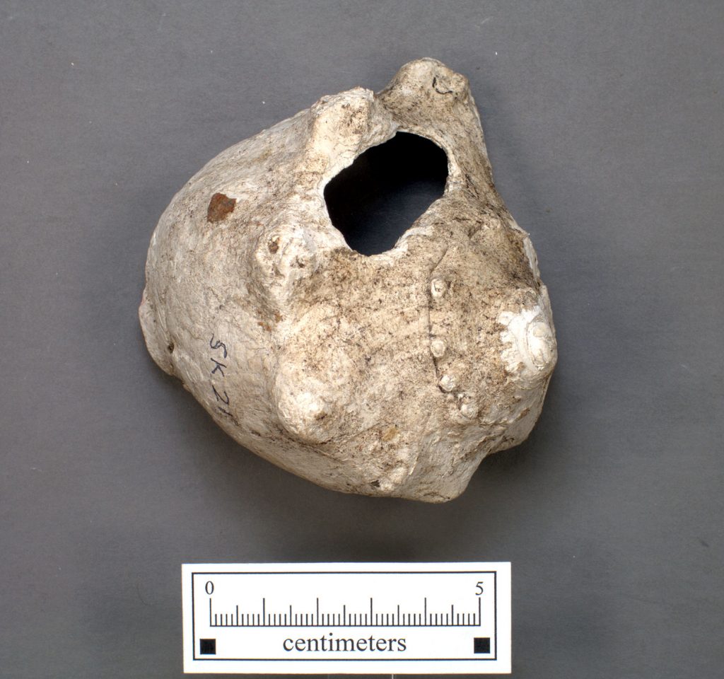
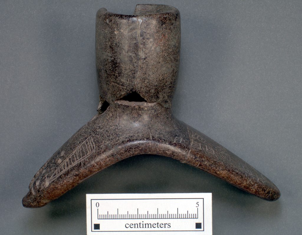
Of particular interest were the fragments of at least twenty-five stone smoking pipes, eight of which could be reconstructed. Nearly all were made of a chlorite schist. Some of these pipes are similar to the platform pipes from Middle Woodland Hopewell sites in Ohio.
In spite of apparent ties to Hopewell, a radiocarbon date of A.D. 970 places the McLean Mound at the beginning of the Late Woodland period. Likewise, ceramics in the mound are similar to later types such Pee Dee and Irene. Rather than assign the sand burial mounds of the inner coastal region to the Cape Fear phase, they are seen as a distinct but yet unnamed Late Woodland cultural phenomenon extending southward into the Coastal Plain of South Carolina and Georgia.
Late Woodland Period (A.D. 800 – 1650)
During the Late Woodland period, physical, cultural, and linguistic differences emerged that can be traced to the ethnohistorically documented tribes who occupied the coast at the time of European contact.
Along the entire length of the coastal Tidewater region of North Carolina, the Late Woodland period is marked by the introduction of shell-tempered pottery. In the Northern Coastal region this practice continued into the Historic period. Late Woodland people of the inner Coastal Plain made pottery that was more similar to that of their Middle Woodland ancestors, with small pebbles added as temper.
The region from the Tidewater coast to the barrier islands, and from Virginia to as far south as Onslow County, was dominated by Algonkian-speaking groups. These groups were responsible for most of the shell-tempered pottery along the coast.
In the Northern Coastal region, the Algonkians were bordered on the west by the Iroquois-speaking Tuscarora tribes. Occupying the inner Coastal Plain from the fall line to the Tidewater, the Tuscaroras made pebble-tempered pottery.
In the Southern Coastal region were Siouan-speaking peoples related to the hill tribes of the Piedmont, whose ceramic traditions are less understood.
White Oak Phase (A.D. 800-1500)
The White Oak phase (aka Oak Island phase) of the Southern Coastal region has many of the same traits as the Colington phase. White Oak phase people lived in longhouses, exploited the estuarine environment, made shell-tempered pottery, and buried their dead is ossuaries. There is evidence that, at least as far south as Onslow County, these people were Algonkian speakers.
Differences between the White Oak/Oak Island ceramics and the Colington series include a lack of incised decorations and infrequency of burnishing in the south. Numerous radiocarbon dates place the White Oak phase between A.D. 800 and 1500.
Several White Oak phase longhouses have been excavated. One long house at the Broad Reach site was partitioned with an interior wall.
Bundled and randomly mixed remains of many individuals in mass secondary burials in ossuaries are a trait of the White Oak phase. Three White Oak phase ossuaries, including one at Broad Reach site, are known to date to approximately the fourteenth century.
Although ossuary burials seldom contain grave goods, one at Broad Reach site contained two shell-tempered White Oak pottery vessels, a small ground stone cup, cut-shell disk beads, clusters of marginella-shell beads, the remains of a small dog, and a turtle carapace. Another small group burial was associated with eight copper beads.
Higher status individuals may have received treatment in a well-constructed and maintained facility like that shown in John White’s drawing of a coastal Algonkian charnal house. Individuals with lower status may have had different treatment resulting in smaller groups of more fragmented burials.
Close Woodland
The time of contact between Indians living in North Carolina and Europeans arriving from Spain and England varied considerably across the state. The expedition of Hernando de Soto passed through western North Carolina in the spring of 1540. Pardo’s expeditions into the same areas came less than 30 years later. The first English attempts at settlement in northeastern North Carolina came about 20 years after that, starting in 1584. But it was not until after about 1650, when English explorers, traders, and settlers came from Tidewater Virginia, that North Carolina’s Indians felt the brunt of the European presence on their land.
Accordingly, the beginnings of these arrivals do not necessarily herald the beginnings of significant changes in the histories of North Carolina’s tribes. Overall, however, this was a time of sweeping and often devastating change.
Contact Along the North Carolina Coast
The archaeology of Contact in North Carolina’s coastal regions is strongly supplemented by early English exploration and settlement which began here in the late 1500s. As in the Piedmont, Contact archaeology near the coast involves terminal Late Woodland societies entering into trade and political relationships with Europeans.
Following the failed late 16th-century attempt by Sir Walter Raleigh to colonize the North Carolina coast, the successful settlement at Jamestown in Virginia in 1607 gave the English the toehold they needed to expand. However, even with the successful founding of Jamestown, North Carolina’s Indians were given a fifty-year respite before having to deal with Europeans again.
Around 1650, Virginia settlers began to push southward along the coast, starting with the Albemarle region. For the most part, settlers did not venture very far inland at first. Instead they spread southward and stayed near the coast. By 1675 the southern shore of Albemarle was settled and by 1691 newcomers were settling along Pamlico River. Soon after the beginning of the 18th century the area of the Neuse River was settled.
Land-grabbing by aggressive colonists and disruptions caused by the illegal, but lively, trade in Indian slaves that had sprung up after the founding of Charles Town in South Carolina, soon caused an unbearable state of relations between the colonists and tribes. This friction ultimately lead to the Tuscarora War, in which two thousand Tuscarora were killed or sold into slavery. Many of the remnants of the Tuscarora tribe moved to Pennsylvania and New York.
In coastal regions archaeology is just beginning to supplement early historic accounts. An Algonkian village thought to be Croaton has been excavated on Hatteras Island. Amity, a mid-17th century village near Lake Mattamuskeet in Hyde County, has been excavated, and work has been done on the historic Tuscarora communities and forts. There is a great deal yet to discover about the archaeology of Contact along the coast.
Pottery-making, subsistence, and patterns of settlement seem to have changed little during the first part of Contact along the coast. Ceramics similar to those of the Cashie, Colington, and White Oak/Oak Island phases continued to be made. Longhouses were still used and a mixed economy based on hunting, gathering, fishing, shell-fish, and agriculture continued. However, aboriginal life was rapidly disrupted as outsiders moved in. By 1701 John Lawson was able to observe that the coastal tribes were “very much decreased.”
Despite the devastation of contact, North Carolina today is the home of the largest Native American population east of the Mississippi River. The robust cultural diversity seen in the archaeological record of the last 12,000 years survives today in the tribal traditions of North Carolina’s native peoples.
Close Historic
-
- Conch shell ornament from the McLean mound in Cumberland Co., NC
-
- Stone platform pipe from the McLean mound in Cumberland Co., NC
-
- Stone pipe from the McLean mound in Cumberland Co., NC
-
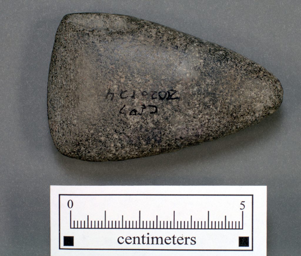
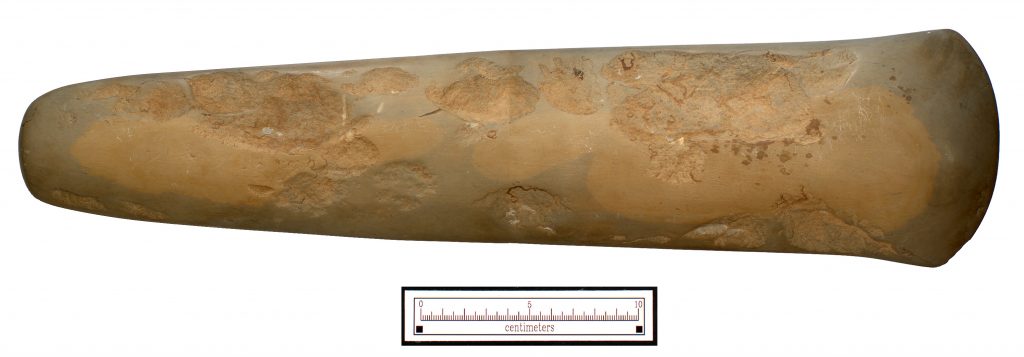
- Stone celt from the McLean mound in Cumberland Co., NC
-
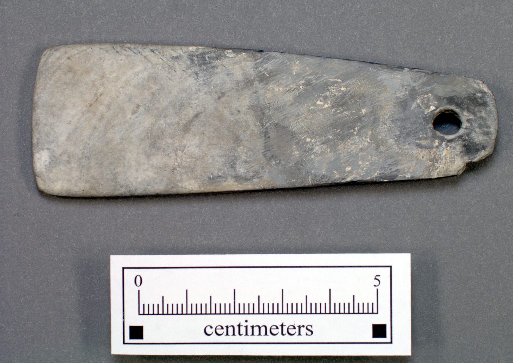
- Slate ornament from the McLean mound in Cumberland Co., NC
-
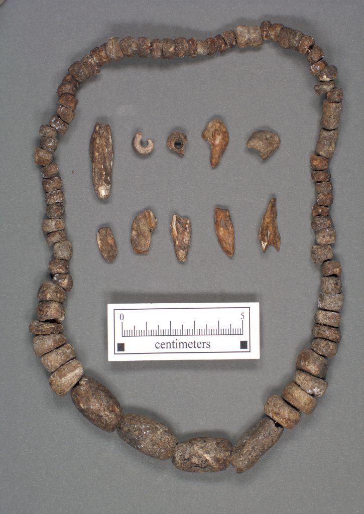
- Shell beads from the McLean mound in Cumberland Co., NC
-
- Portion of Small Ceramic Vessel from the McLean mound in Cumberland Co., NC
-
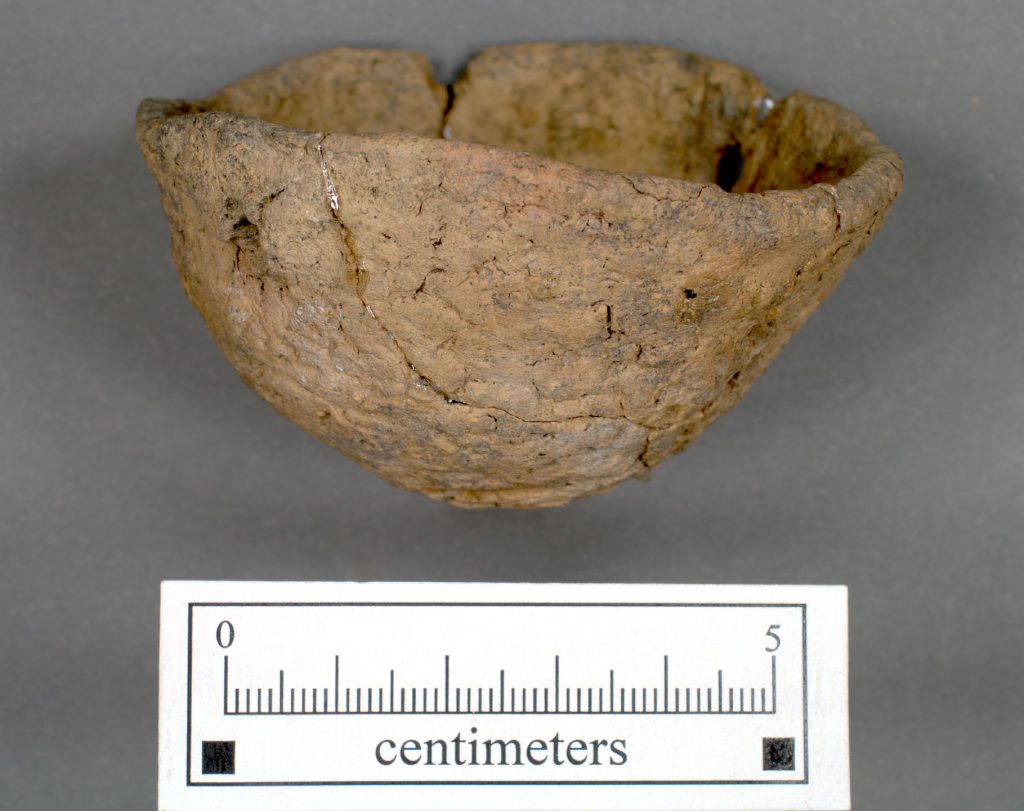
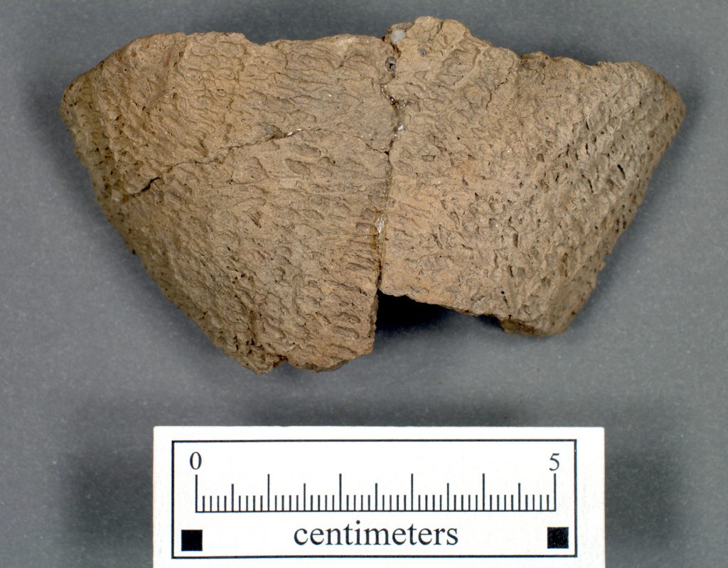
- Fabric-impressed pot from the McLean mound in Cumberland Co., NC
-
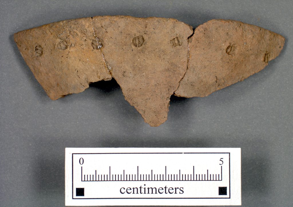
- Plain pot fragment from the McLean mound in Cumberland Co., NC
-
- Large celt in a private collection from Cumberland Co., NC