
Wall (Orange County)
The Wall site (31OR11) is located along a bend of the Eno River in Hillsborough, N.C., and was initially thought to be the site of an Occaneechi village visited by John Lawson in 1701. Instead, it was a compact, palisaded village occupied during the Late Woodland period, from roughly A.D. 1400-1600. The Wall site is important because it represents one of the best examples we have of a large Late Woodland community and allows us to understand how villages grew in size and how people both maintained and altered structures over time.
History of Excavations
During the summer of 1938, Joffre Coe began work on the Siouan project at the Wall site, thinking that it was Occaneechi Town. After brief excavations and a lack of historic artifacts, Coe moved to the Tutelo and Saponi islands near Clarksville, Virginia, where he hoped to identify the historic villages of the two Siouan tribes of the same names. Excavations also were undertaken on Yadkin River near the historic Trading Ford and on Dan River just below the mouth of Smith River. These were thought to be sites of two other historic Siouan villages–Saponi Town and Lower Saratown. The funds for these excavations were provided by Mr. Eli Lilly, of pharmaceutical fame, and the Indiana Historical Society.
While Coe did not find the historic trade artifacts he expected, he did find many other artifacts and the 1938 Wall site excavation revealed evidence of a well-preserved Indian village containing the remains of circular post-in-ground houses and trash-filled pits. And, Coe remained convinced that Wall likely represented the early eighteenth-century Occaneechi village. In order to explore the site more fully, the University of North Carolina applied to the Federal Works Progress Administration (WPA) for funds to undertake a statewide archaeological project that included significant excavations at the Wall site and the Frutchey mound (now Town Creek Indian Mound State Historic Site).
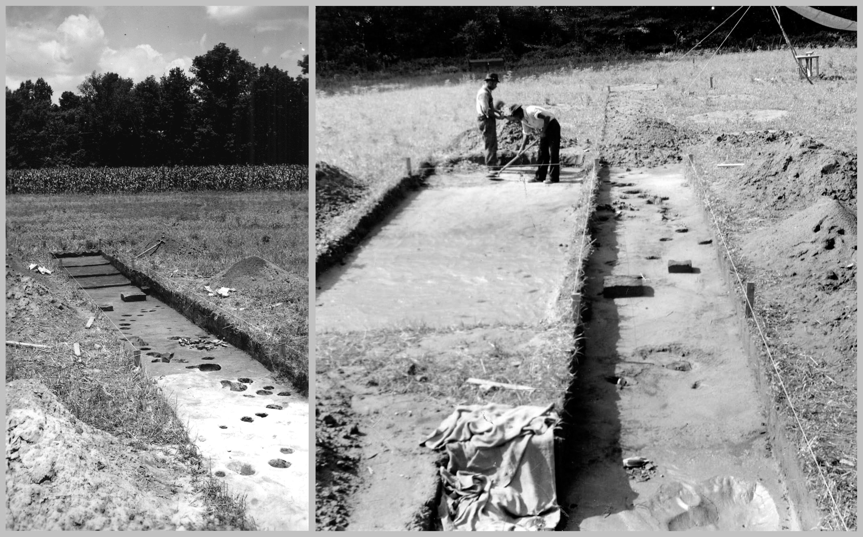
In 1940, the statewide WPA project was approved and UNC hired Robert Wauchope to head the newlt-established Research Laboratories of Anthropology (RLA; now of Archaeology); he had just completed a similar project in northern Georgia. Shortly after arriving in North Carolina, Wauchope resumed excavations at the Wall site, while Coe worked at Town Creek. From 1940 to 1941, Wauchope and his crews uncovered a large area of roughly 12,000 square feet. They revealed several houses, multiple stockade alignments, burials, and other pit features.
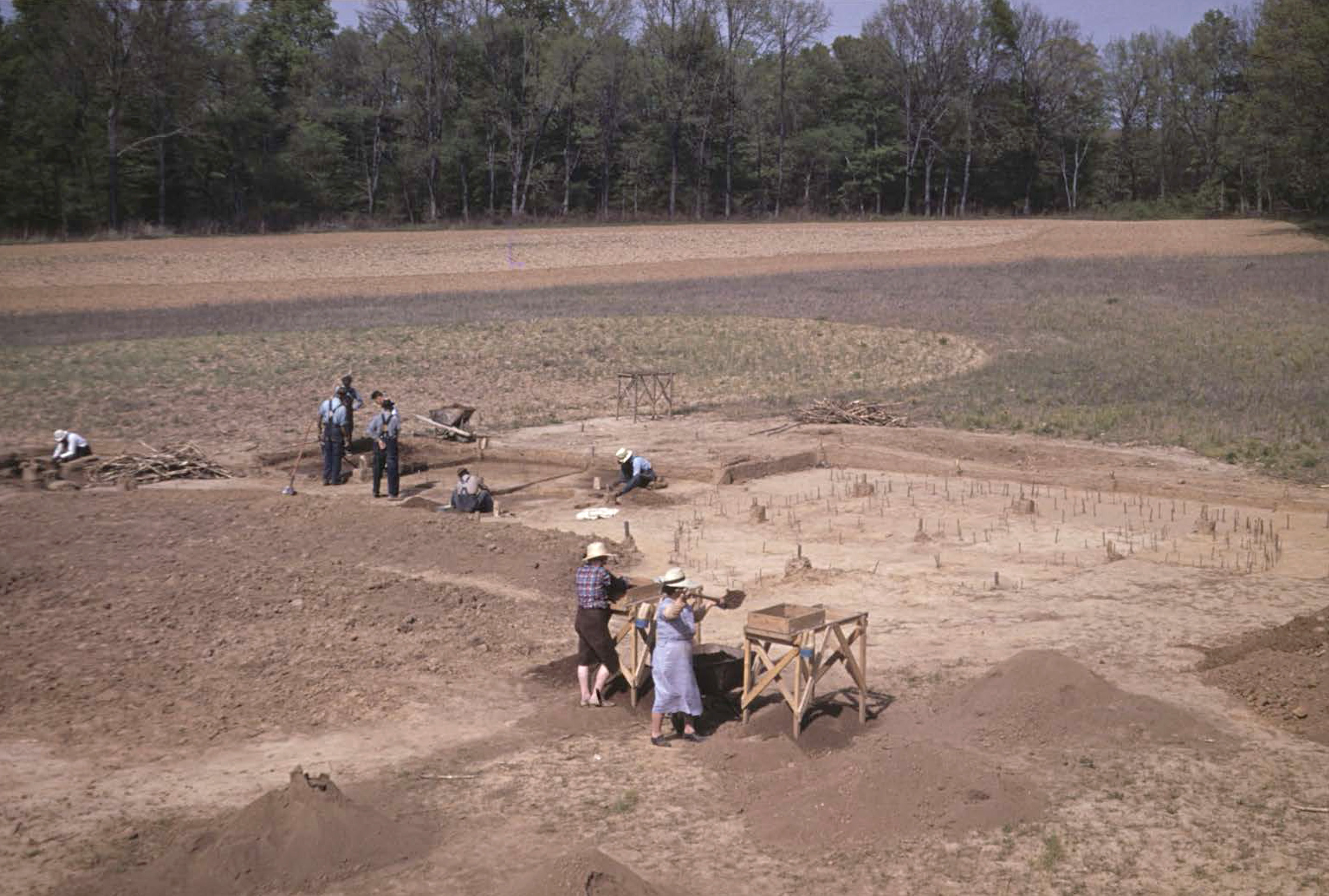
Excavations resumed in 1983 as part of the RLA’s newly organized Siouan project. Archaeologists still believed that the Occaneechi site was located in the same vicinity as the Wall site and the hope was that by using more refined screening techniques, the researchers could recover small trade artifacts that may have previously been missed. Still, however, European-made artifacts were only recovered from the plowzone and dated to the late eighteenth century, not the early eighteenth century. Radiocarbon samples dated from charcoal found in Wall site features confirmed that the site was occupied during the middle of the 15th century. Additional excavations took place in 1984, 2001-2002, and 2015.
What Did the Community Look Like?
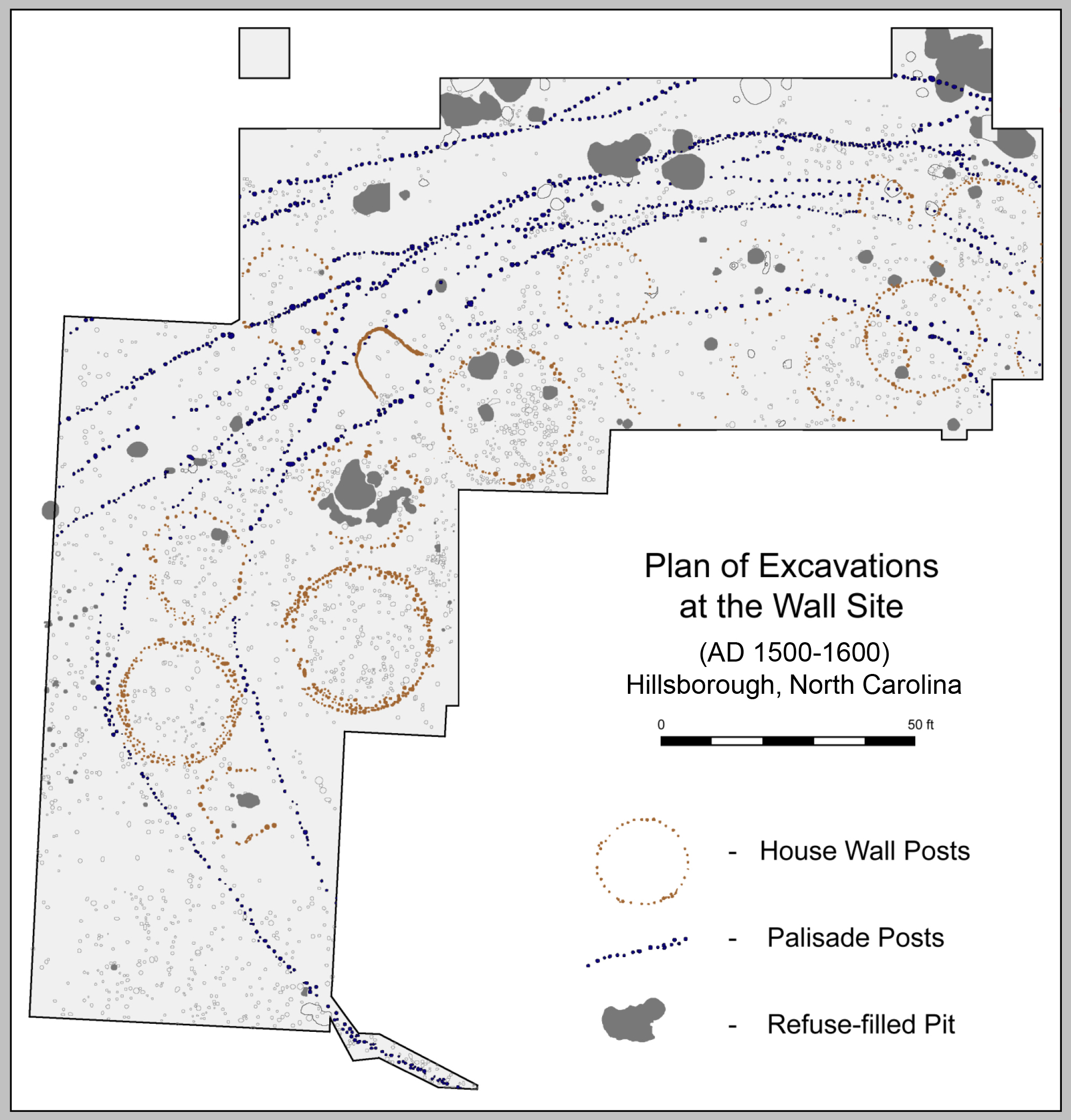
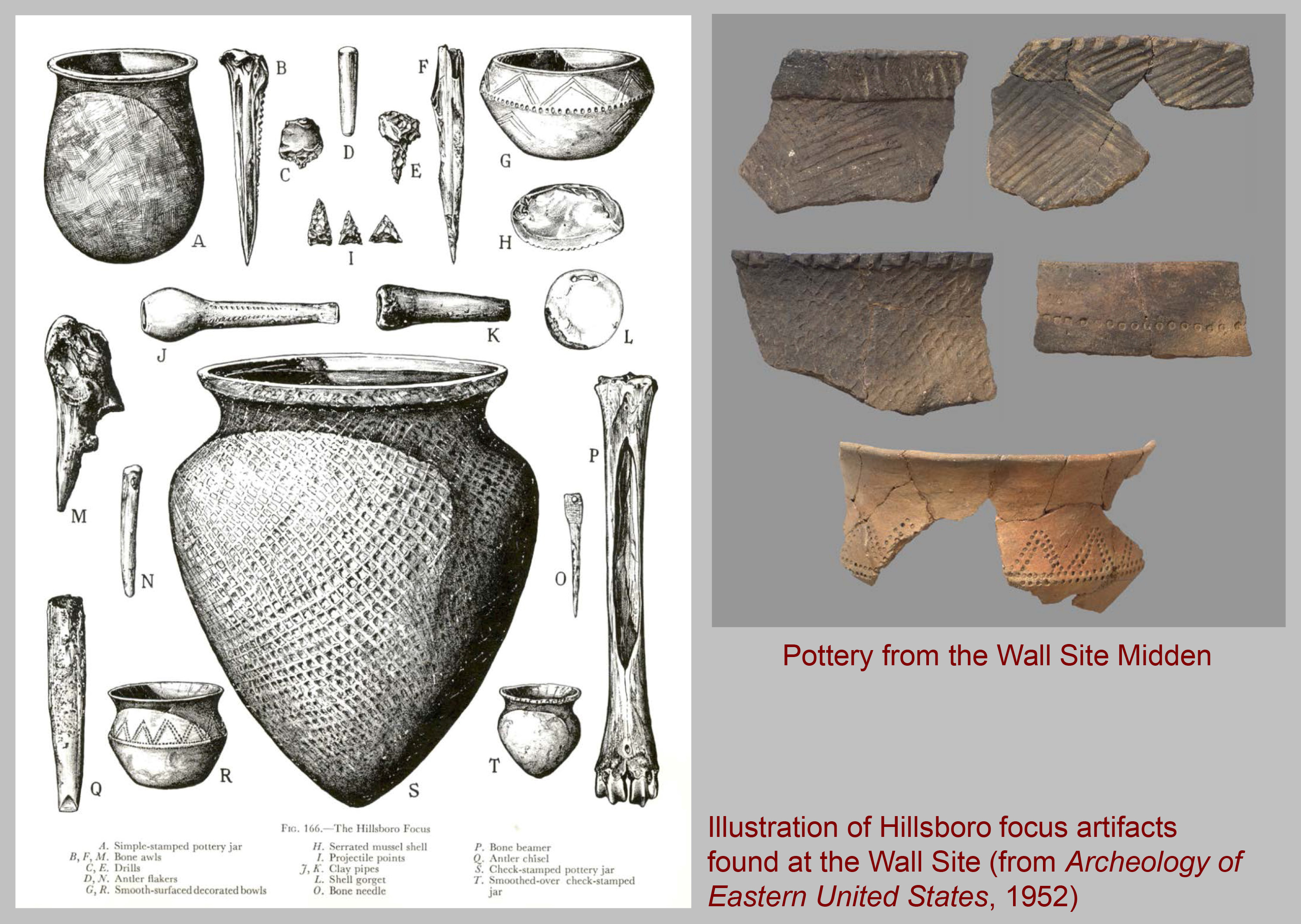
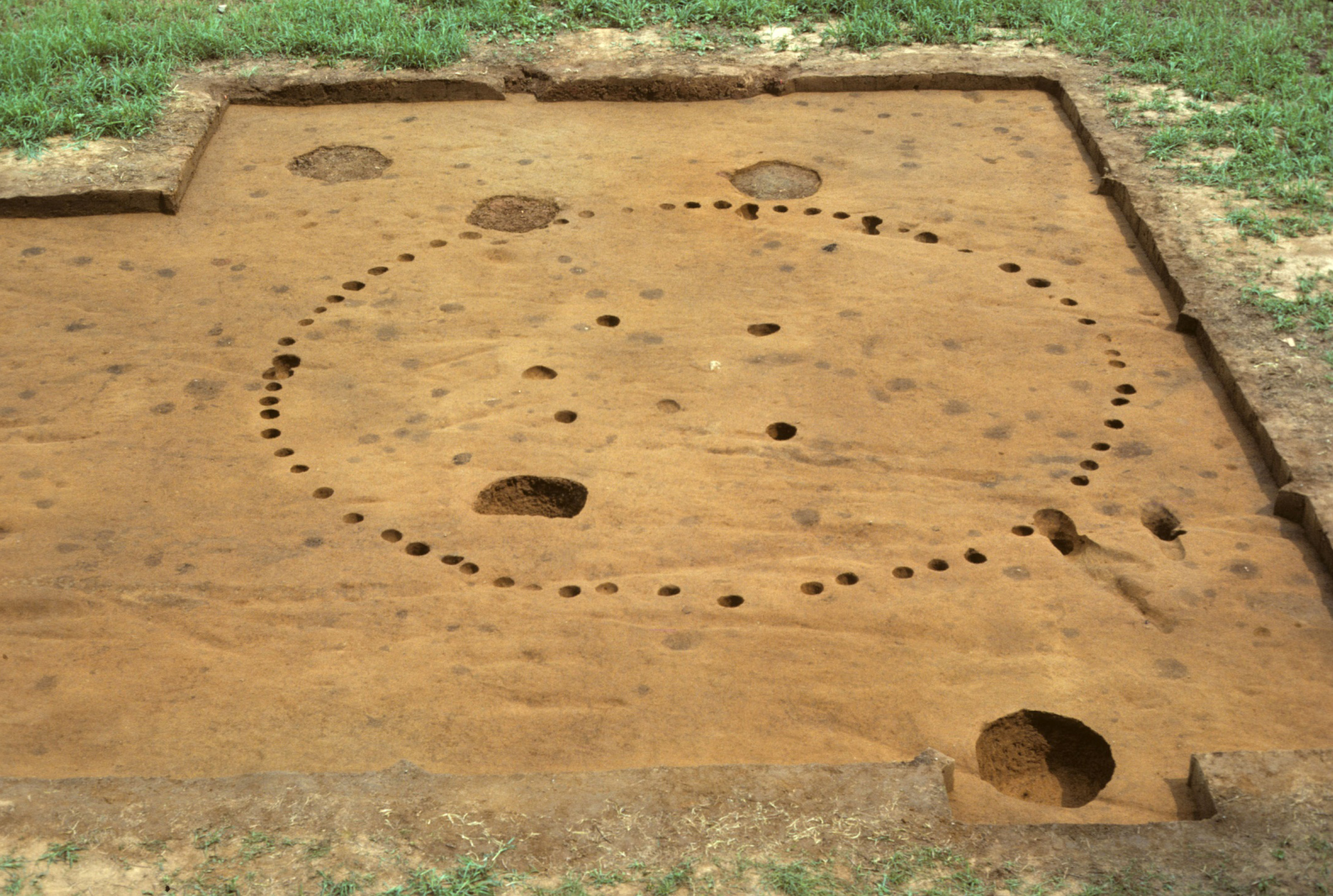
The Wall site represents one of the best examples of a compact, nucleated village with relatively large population. Overall, archaeologists think that Wall was occupied by a group of about 100 to 150 people for less than 20 years. The site is estimated to cover about 1.25 acres, roughly one third of which has been excavated. These excavations have uncovered circular houses averaging 25 ft. in diameter, two special purpose structures that may represent storage buildings, eight burials, multiple pit features, five stockade alignments, and a thick midden deposit surrounding the ring of houses.
Together, the evidence from excavations helps us to reconstruct what the village would have looked like. Initially, the village would have been a ring of circular houses surrounding an open plaza. Because there is no evidence for central support postholes, it appears that the houses were of bower construction (i.e. like a wigwam), and not wattle-and-daub. As the population grew and the village expanded, the stockade was taken down and rebuilt, a process that happened at least five times. In some cases houses were rebuilt, while in other cases they were repositioned to make way for new houses.
Burials
Most of the burials found at Wall consist of shaft-and-chamber pits. A shaft-and-chamber pit consists of a cylindrical shaft dug into the subsoil and then a tunnel-like chamber dug off to one side at the bottom of the shaft. The body of the deceased was placed in a flexed or fetal position, wrapped in mats, and placed in the chamber. The chamber was then sealed with timbers or large stones and the shaft was filled with the soil that had been dug out. Two graves at Wall also had upper layers of fill that were rich in food remains and other refuse, similar to the fill that was found in roasting pits. One interpretation of this is that feasting may have been an important aspect of mortuary ritual.
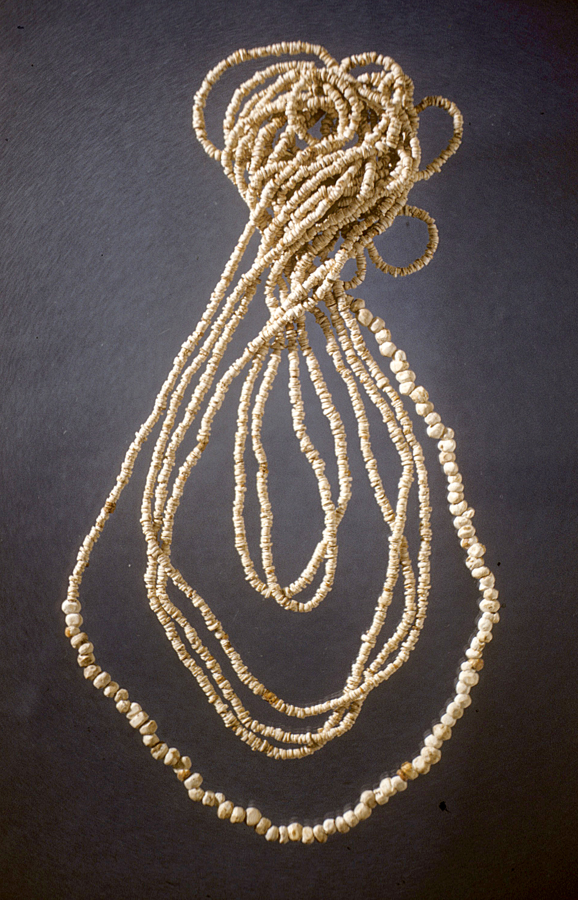
All of the burials were oriented with their heads pointing eastward and were usually located within or just outside houses. Grave offerings were clay pots that probably originally held food remains that would have sustained the deceased on their journey to the other world. Shell beads were often sewn on burial garments or strung and placed on the bodies as jewelry. Engraved shell gorgets were also sometimes hung around the necks of children. The small number of burials (eight) found at the Wall site suggests a much lower mortality rate compared to later sites like Fredricks and Upper Saratown.
Subsistence
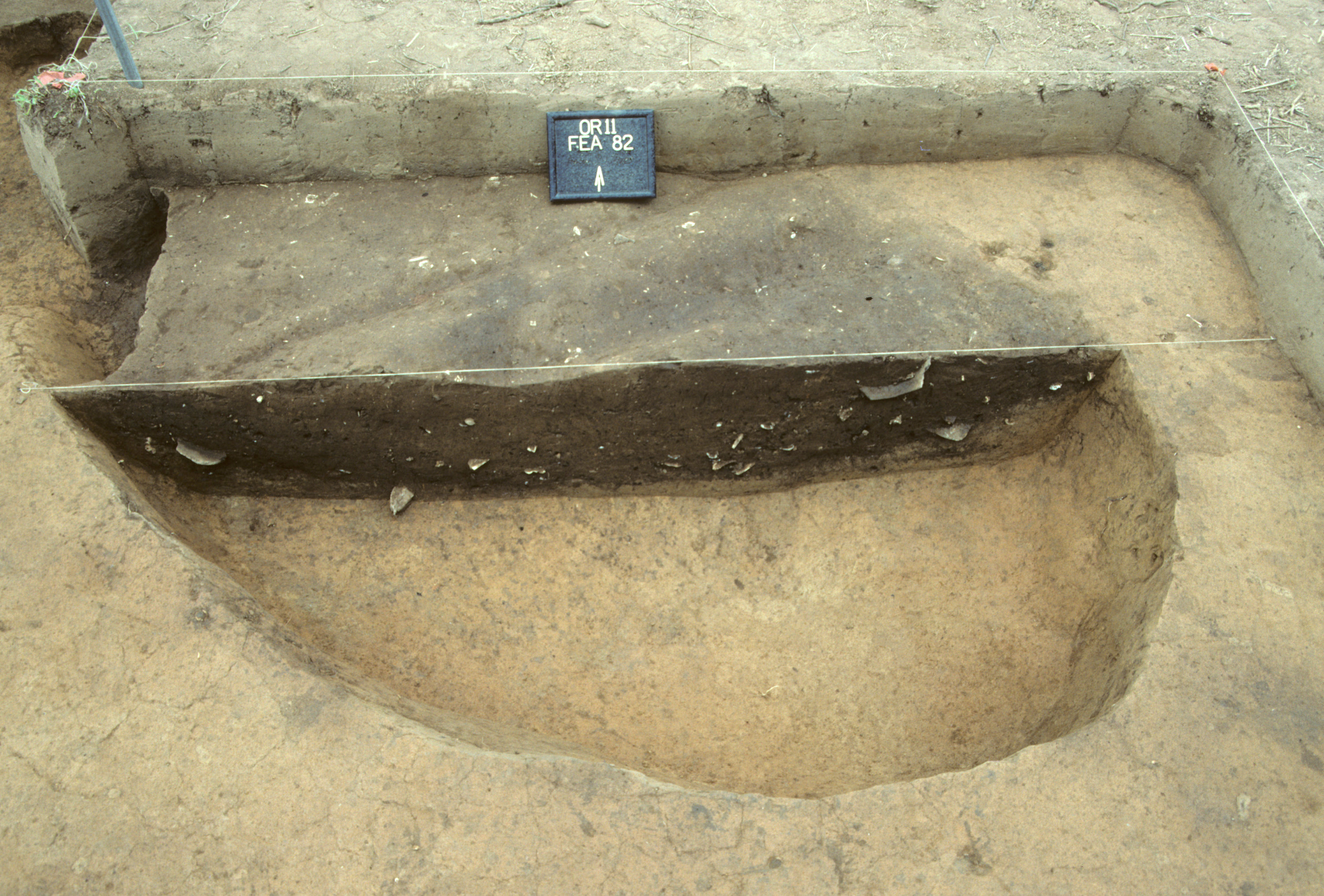
Some of the large, shallow, basin-like features found at the Wall site have been interpreted as communal roasting pits. They may have been used to prepare food for large feasts marking community-wide ceremonies and celebrations. These pits contained large amounts of plant and animal refuse, as well as charcoal, ash, and fire-cracked rocks. The area where the Wall site is located, along a bend in the Eno River, would have represented rich bottomlands, planted in fields of corn, beans and squash. The edges of cultivated lots would have provided wild fruits and berries, while the surrounding hardwood forest would have provided seasonal supplies of acorns, hickory nuts, and walnuts. For the people living in the village, the primary source of meat was white-tailed deer, although small mammals, turtles, fish, wild turkeys, and passenger pigeons supplemented venison.
Sources
Davis, Jr., R.P. Stephen
2009 • Hillsborough Archaeological District, North Carolina. In Archaeology in America: An Encyclopedia, Volume I, Northeast and Southeast, edited by Francis P. McManamon, pp.333-338. Greenwood Press, Westport, CT.
Ward, Trawick H., and R.P. Stephen Davis, Jr.
1998 • Time Before History: The Archaeology of North Carolina. University of North Carolina Press, Chapel Hill.